Bellin, Nicolaus
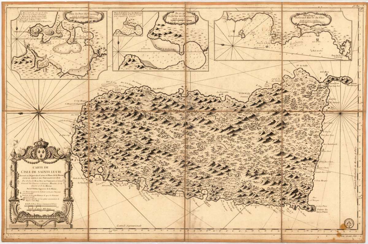
Carte de L´Isle de Sainte Lucie Dressee au Depost des Cartes et Plans de la Marine Pour Le Service des Vaisseaux du...
Prices incl. VAT plus shipping costs
This item is sold. Please contact us if you are searching for this item.
- Published: N. Bellin , Paris
- Published date: 1763
- Type: Antique Map
- Technique: Copper engraving / Uncolored.
- Issue date: 1763
- Category: St. Lucia
- Size: 575 by 895mm (22¾ by 35¼ inches).
- Stock number: 29359
- Condition: Dissected in eight parts and mounted on linen of the period. A few small pin holes in the outer four cornes of of the map sheets or the linen. In the lower right corner next to the stamp ,Depot de la Marine' two spots of of candle wax. Overall in very good excellent condition.
Article description
Copper engraving, uncolored, dissected and mounted on linen. A fine engraved map. Highly detailed and large scale map of the island of St. Lucia in the Caribbean Sea. Detailed title cartouche with dedication. The top of the map with three large inset maps of bays in St. Lucia: Port du Carenage, Cul de sac des Roseaux and Mouillages du Grand Islet et du Choc. With the stamp ,Depot de la Marine' in the lower right corner. Jacques Nicolas Bellin (1703-1772) was one of the most important French cartographers of the mid-eighteenth century. He was appointed the first Ingenieur Hydrographe de la Marine, and also Official Hydrographer to the French King. Nicolaus Bellin produced a substantial number of important separately issued maps, particularly reflecting continuing discoveries and political events in the Americas. His maps and charts were finely engraved and produced, and set a high standard of accuracy.
You might also be interested in the following products
 Pas kaart Van de...
  Isle de la...
  Isle De La...
  Martinico to...