Homann, Johann Baptist
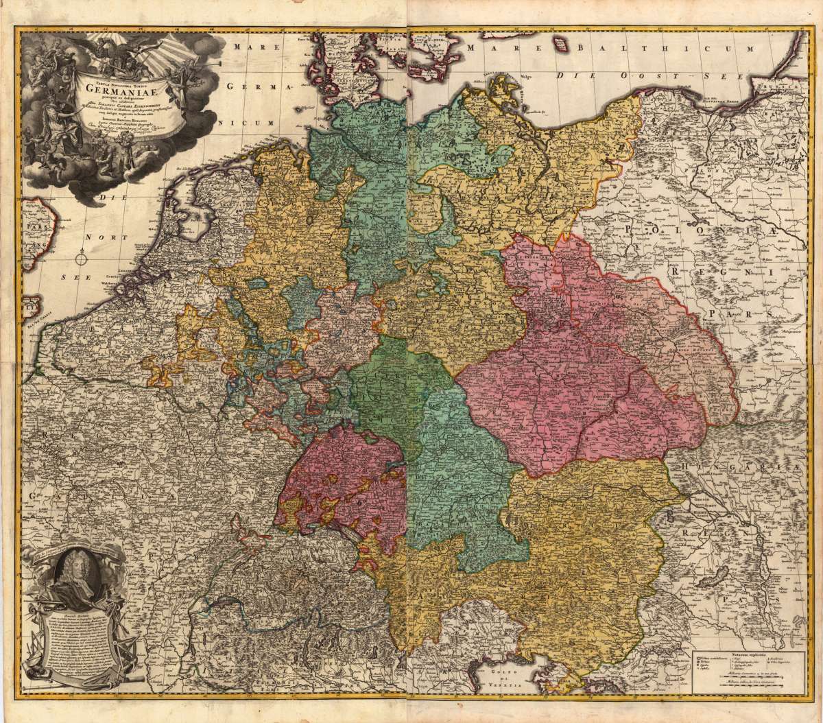
Tabula Novissima Tottus Germaniae praecipué ex designatione viri celeberrimi Dni Johannis Caspari Eisenschmidii...
€2,430.00
Prices incl. VAT plus shipping costs
This item is sold. Please contact us if you are searching for this item.
Eigenschaften
- Published: Homann , Nürnberg
- Published date: 1716
- Technique: Copper engraving / Original color.
- Type: Antique Map
- Issue date: 1716-20
- Category: Germany
- Size: 942 by 1138mm (37 by 44¾ inches).
- Stock number: 19510
- Condition: In excellent condition.
Article description
Article description
Copper-engraving, hand colored in outline and wash when published. This fine decorative large antique map of Germany, printed from four plates, shows Germany its neighbouring counries. The map is based on the cartographic sources of Johann Kaspar Eisenschmidt. A highly decorative map with a large allegoric title cartouche in the upper left corner. Below in the left corner is a portrait of J.C. Eisenschmidt with an extensive explanation for the reader. Further the map is equipped with many place names, rivers, streets, mountains, etc. and other cartographic details. In the right lower corner is a milage scale.
You might also be interested in the following products
 Karte von...
 Original Kupferstich in Grenz- und Flächenkolorit. Dargestelllt wird Gesamtdeutschland. Teile von Frankreich, die...
€400.00
 Germania Antiqua...
 Copper engraving, in contemporary original color in outline. Published in Zatta's ,Atlante Novissimo'....
€125.00
 Deutschland
 Antike Kupferstichkarte, unkoloriert erschienen im Atlas historique... v. H. Chatelein. Rechts und links neben dem...
€195.00
 Deutschland oder...
 Original copper engraving, hand colored in outline when published. Original Kupferstichkarte in zeitgenössischem...
€190.00
Recently viewed products