Santini, Francois and Remondini, M.
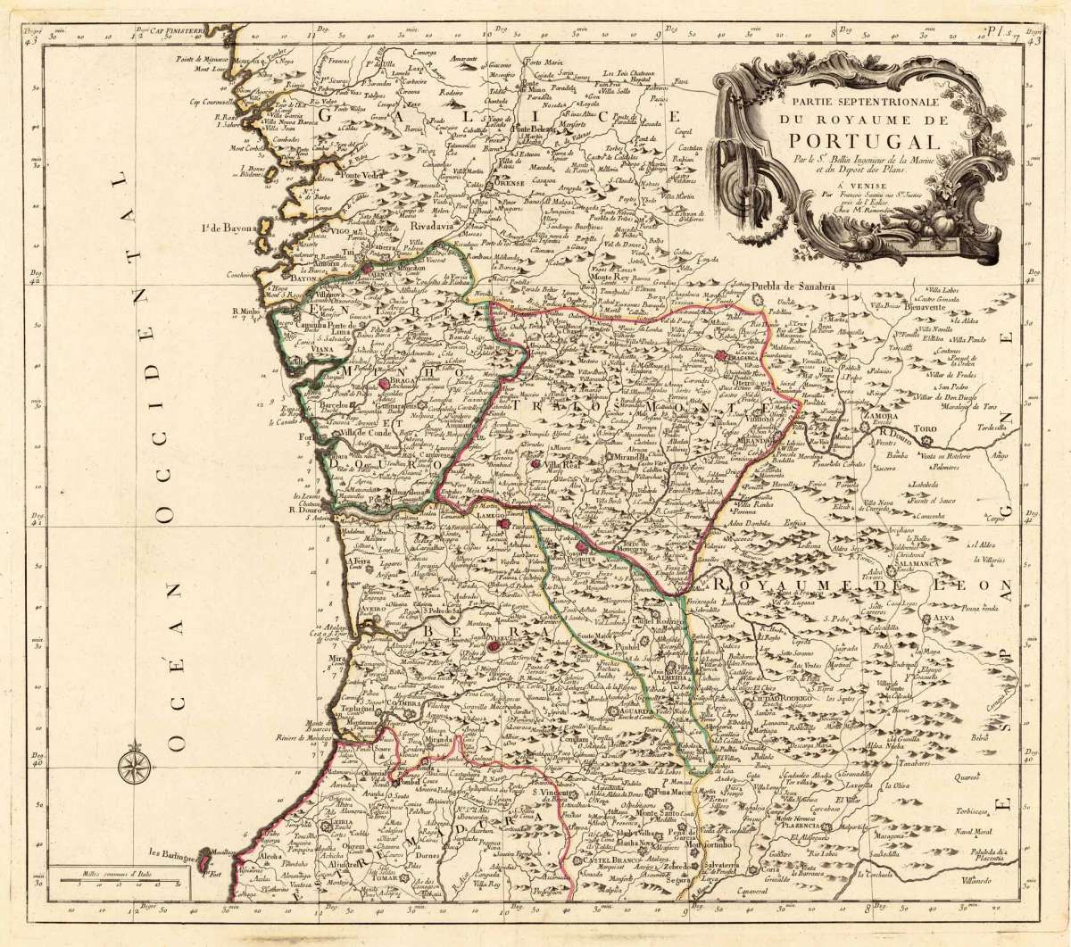
Partie Septentrionale du Royaume de Portugal Par le Sr. Bellin Ingenieur de la Marine et du Depost des Plans. A'...
Eigenschaften
- Published: Santini Chez M. Remondini , Venice
- Published date: 1776
- Technique: Copper engraving / Original color.
- Type: Antique Map, map
- Category: Portugal
- Issue date: 1776-80
- Size: 477 by 540mm (18¾ by 21¼ inches).
- Stock number: 27336
- Condition: In excellent condition.
Article description
Article description
Copper engraving, hand colored in outline. Shown is the northern part of the kingdom of Portugal towards Gallizia. The antique map includes the southern part of Gallizia with the city of Orense in its centre. Northern Portugal is well shown on the map. including the cities Braga, Villa real, Braganca, Lamego and Coimbra. This old map is based on the cartographic source by Sr. Bellin (Nicolaus Bellin) and was published here with M. Remondini in Venice in 1779. The political borders of the individual regions and principalities are hand colored in outline. In the upper right corner with a decorative floral ornated title cartouche. At the bottom left a mileage scale. The map is equipped with many small place names, rivers, mountains, lakes and islands along the coastline, showing even depths in the sea. The map first appeared in Santini's Atlas Universel in 1776-79 in Paris. In 1784 Santini sold the plates of the maps to M. Remondini, who published then these maps in Venice with his additional imprint in the title cartouches.You might also be interested in the following products
 Zahara - Bornos
 Original antique hand colored copper engraving, published in volume V of the town book "Civitates Orbis...
€480.00
 De Cust van...
 Detailled handcoloured sea-chart showing the Portugese coastline from Setubal S. Vves along the Algarve towards Palos...
€850.00
 Partie...
 Copper engraving, hand colored in outline, when published. Decorative map of Portugal. Divided up by outline color...
€245.00
 Der Thurm Belem...
 Copper engraving, hand colored in wash and outline, published in Allain Manesson Mallet's description of the...
€55.00
Recently viewed products