Stanley, Henry M.
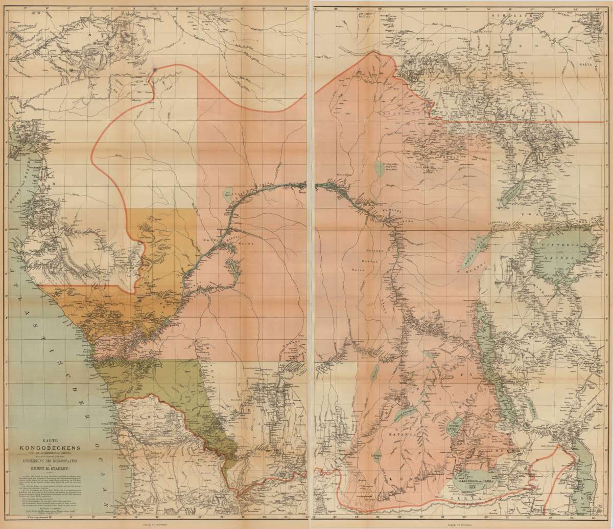
Karte des Kongobeckens und der angrenzenden Gebiete, Zugleich Ausdehnung des Kongostaates. Von Henry M. Stanley
€145.00
Prices incl. VAT plus shipping costs
This item is sold. Please contact us if you are searching for this item.
Eigenschaften
- Published: Leipzig
- Published date: 1877
- Issue date: 1877
- Type: map
- Technique: Chromolithograph, printed in colors.
- Size: 92 x 107 cm (36.25 x 42,25 inches).
- Stock number: 33427
- Condition: Folded map in excellent condition.
Article description
Article description
Original antique chromolithograph, hand colored when published.. Large chromolithographed map of the Congo River Basin.
You might also be interested in the following products
 Africae Antiquae,...
 Original antique copper engraving, decorative hand colored in outline and wash. A highly decorative map, which is...
€595.00
 Africae Antiquae,...
 Copper engraving, decorative hand colored in outline and wash. Published in a Dutch text edition of J. Jansson's...
€595.00


Recently viewed products