Robert, Sr.
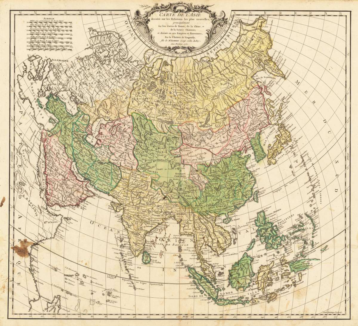
Carte De L' Asie dressée sur les Relations les plus nouvelles, principalement sur les Cartes de Russie, de la...
€240.00
Prices incl. VAT plus shipping costs
This item is sold. Please contact us if you are searching for this item.
Eigenschaften
- Published: Paris
- Published date: 1751
- Category: Asia
- Technique: Copper engraving / Original color
- Issue date: 1751
- Type: map
- Size: 480 by 525mm (19 by 20¾ inches).
- Stock number: 36599
- Condition: Some stains on the lower left side and some small ones at the center fold. On the full sheet as published. 480 by 525mm (19 by 20¾ inches).
Article description
Article description
Original antique copper engraving, hand colored in outline, when published. Detailled map by the French cartographer Sr. Robert de Vaugondy. The map pretty much to date on the newest cartographic sources for this period around 1751. Already Diemens land in the northeast part of Australia is shown. The map itsself provides many names of cities and towns, rivers and mountains are as well engraved. An ornated title cartouche is in the upper center of the map and a milage scale in the upper left corner.
You might also be interested in the following products
 Nouvelle...
 Copper-engraving, engraved after or on behalf of Robert de Vaugondy. Published in the geographical supplement of the...
€110.00
 Asiae Nova...
 Original copper engraving, oldcolored, published 1582 in Antwerpen in the atlas "Theatrum Orbis Terrarum". This is...
€2,200.00
 Von den Ländern...
 Woodcut, hand colored in wash. Decorative hand colored woodcut map of the , published in a German text edition of...
€85.00
 Von den Ländern...
 Woodcut, hand colored in wash. Decorative hand colored woodcut map shows a sciene of animals, published in a German...
€85.00
Recently viewed products