Tallis, J & F.
Part of South Australia
€125.00
Prices incl. VAT plus shipping costs
This item is sold. Please contact us if you are searching for this item.
Eigenschaften
- Published: John Tallis & Company , London & New York
- Published date: 1851
- Type: Antique Map, map
- Issue date: 1851
- Technique: Steel engraving, hand colored.
- Category: South Australia
- Size: 342 by 246mm (13½ by 9¾ inches).
- Stock number: 29659
- Condition: In excellent condition.
Article description
Article description
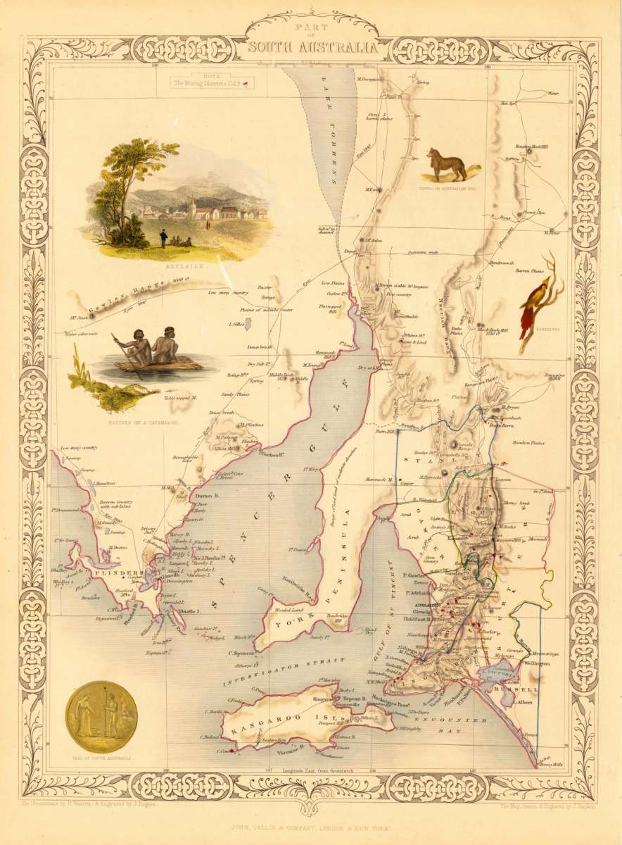
Steel engraving, hand colored in outline and wash. The fine engraved map is showing a part of South Australia from Lake Torrens to Kangaroo Island, with place names and named features, showing counties and mining districts. Mapping of the coast from Elliston in the west to the Coorong in the east, and from Kangaroo Island in the south to Mt. Deception in the north. The map is decorated with five finely hand colored engraved vignettes: a view of Adelaide with Aboriginals in the foreground, a dingo or Australian dog, a nymphicus (parrot), natives on a catamaran and the Seal of South Australia. The actual map was drawn and engraved by J. Rapkin. The illustrations were engraved by various artists: R. Radclyffe, W. Lacy, J. Rogers, J. H. Kernot, J. B. Allen, T. Fleming, H. Winkles, R. Baker after drawings by H. Warren, H. Winkles and H. Wray.You might also be interested in the following products
 Australien.
 Lithograph, hand colored in outline when published. This map shows Australia with the Pacific Ocean. Inside the map...
€150.00
 Western Autralia...
 Steel engraving, hand colored in outline when published. This map shows West Australia.
€182.00


Recently viewed products