Mercator, Gerhard
China
Prices incl. VAT plus shipping costs
This item is sold. Please contact us if you are searching for this item.
- Published: Amsterdam
- Published date: 1619
- Category: China
- Issue date: 1623
- Type: map
- Technique: Copper engraving / hand colored.
- Size: 34 x 46 cm (13.5 x 18 inches).
- Bibliography: 8410:1A
- Stock number: 34639
- Condition: In good condition, browned with brown spots. Fine bruise lines along the usual center fold.
Article description
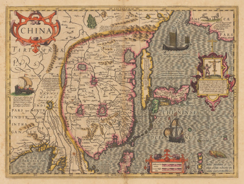
Original antique copper engraving, hand colored when published. Latin text edition. The decorative and early map of China is equipped with renaissance title cartouches, richly figurative scenes and elaborated with engraved sea monsters, sailing ships and land wagons with sails in Tartary. China is already shown with a large amount of place names, the Great Wall, rivers, larger lakes and engraved mountains. The Chinese Sea extends from the Anian Street with the neighboring Northwest coast of America, across Korea, which is here shown as an island, and across Japan towards the northern Philippines.
8410:1A


