Tallis, J & F.
Independent Tartary
€145.00
Prices incl. VAT plus shipping costs
This item is sold. Please contact us if you are searching for this item.
Eigenschaften
- Published: John Tallis & Company , London & New York
- Published date: 1851
- Type: Antique Map, map
- Issue date: 1851
- Category: Tartary
- Technique: Steel engraving, hand colored.
- Size: 252 by 325mm (10 by 12¾ inches).
- Stock number: 29632
- Condition: In excellent condition.
Article description
Article description
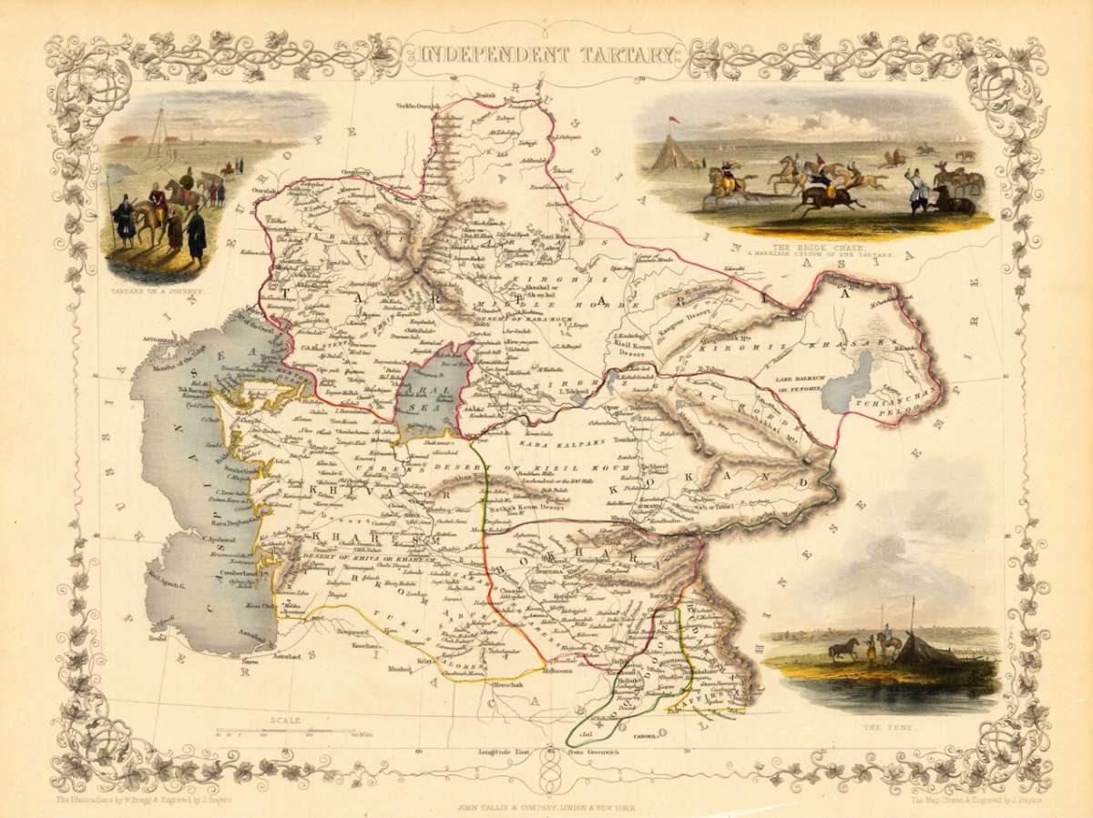
Steel engraving, hand colored in outline and wash. Decorative antique map of the Independent Tartary with many details. It shows the regions between the Caspian Sea and Lake Bakquash and between Russia and Afghanistan. Included is the ancient silk route, the kingdoms of Khiva, Tartaria, Kokand and Bokhara. Three beautiful vignettes with Tartars on a journey, a horseback bride chase, and a tartar campsite. The actual map was drawn and engraved by J. Rapkin. The illustrations were engraved by various artists: R. Radclyffe, W. Lacy, J. Rogers, J. H. Kernot, J. B. Allen, T. Fleming, H. Winkles, R. Baker after drawings by H. Warren, H. Winkles and H. Wray.You might also be interested in the following products
 Tabula Asiae II...
 Fine copper-engraved map, printed into the full text page, published in Geografia ... Universale de la Terra , which...
€145.00
 Tartariae Imperium
 Fine copper-engraved map, printed into the full text page, published in 'Geografia ... Universale de la...
€509.00
 Von den Ländern...
 Woodcut published 1628 in the Cosmographia by Sebastian Münster. Early woodcut map published in the 1628 edition...
€95.00
 Dwina Fluuius.
 Original antique copper engraving, hand colored in outline and wash when published. The map is divided into three...
€300.00
Recently viewed products