€550.00
Prices incl. VAT plus shipping costs
This item is sold. Please contact us if you are searching for this item.
Eigenschaften
- Published: London
- Published date: 1914
- Technique: Steel engraving
- Issue date: 1914
- Type: map
- Category: Atlantic Islands
- Size: 96.8 x 68,2 cm (38 x 26,75 inches).
- Stock number: 34649
- Condition: In good condition.
Article description
Article description
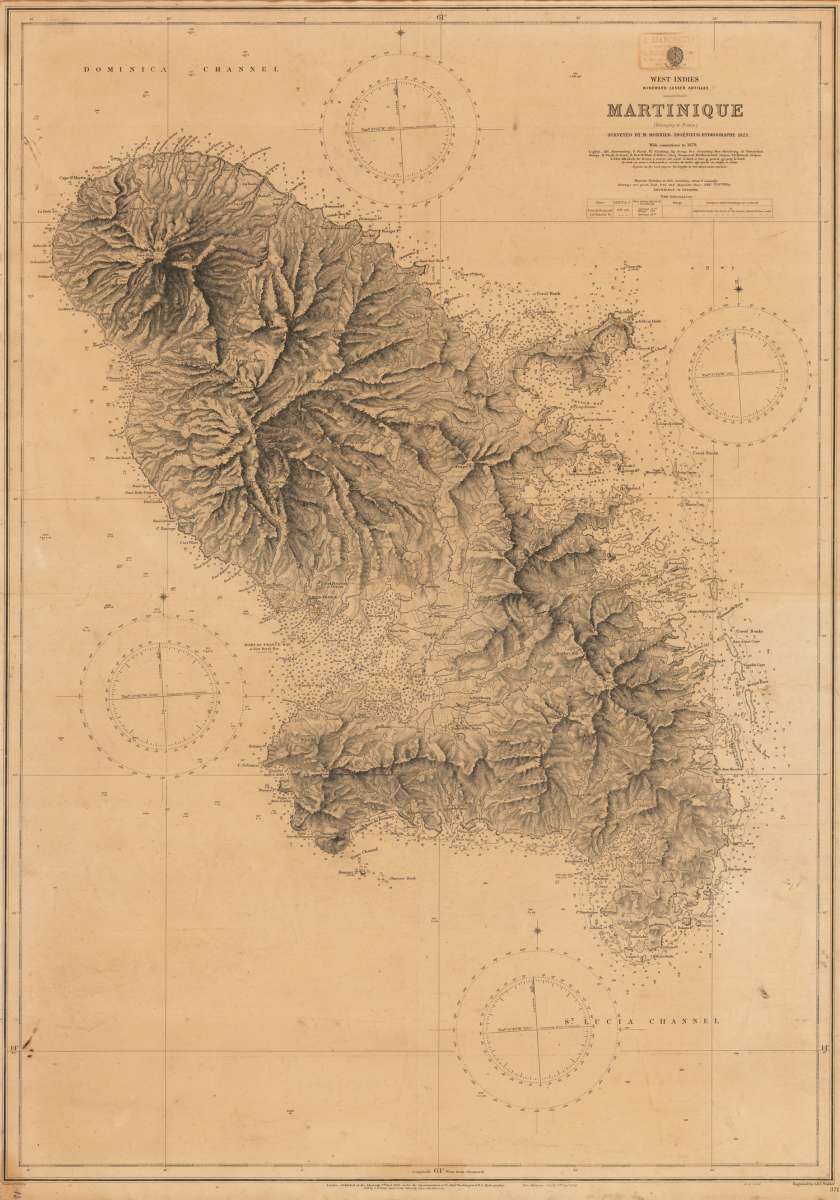
Original antique steel engraving. New edition from 1914 of a very beautiful French nautical map of Martinique, first published at the Admiralty 1863, large with corrections to 1879. Admiralty chart, designed as an aid to navigation at sea, Chart Number 371. Shows detail both inland and at sea with topography of the enitre island, many soundings and nautical details of the coast.(Belonging to France)
You might also be interested in the following products
 Nieuwe Paskaert...
 Original antique copper engraving, uncolored as published. This sea chart shows Gualate. In the upper right corner...
€545.00
 Nieuwe Paskaert...
 Original antique copper engraving, uncolored as published. The Dutch firm and printing house van Keulen was one of...
€495.00
 Eyland Mayo -...
 Copper engraving, uncolored as published. Along the coastlines engraved anchor places, as well names of the bays,...
€45.00
 Isles du...
 Original antique copper engraving, uncolored as published. This map shows the Isles of Cap Verde which are St....
€75.00
Recently viewed products