Visscher, Nicolaus & Schenk, Petrus
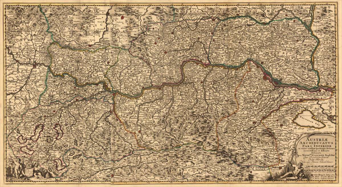
Austriae Archiducatus Pars Inferior in omnes ejusdem Quadrantes Ditiones accuratissime et distinte delineata per...
€750.00
Prices incl. VAT plus shipping costs
This item is sold. Please contact us if you are searching for this item.
Eigenschaften
- Published: P. Schenk jun. , Amsterdam
- Published date: 1740
- Technique: Copper engraving / Original color.
- Type: Antique Map, map
- Category: Lower Austria
- Issue date: 1740
- Size: 468 by 858mm (18½ by 33¾ inches).
- Stock number: 16628
- Condition: In excellent condition. 468 by 858mm (18½ by 33¾ inches).
Article description
Article description
Copper-engraving, handcolored in outline when published. Decorative large map of mainly lower Austria, showing the river Danube from Passau towards Vienna. The map is providing a lot of information on placenames of smaller cities and villages. Castles, monastries, rivers, lakes, mountains and more are detailed engraved. Originally published by Nicolaus Vischer, here with the imprint by Petrus Schenk, Amsterdam around 1740s. In the lower corners with a decorative allegoric (on the rivers Danube probably) title cartouche with milage scale and table of explanations. In the lower left corner two angels holding the coat of arms of the Austrian empire. A large and decorative map of upper Austria, due of the large size of the map with several older folds from the atlas.You might also be interested in the following products
 Elegantissimus a...
 Original antique hand colored copper engraving, published in volume V of the townbooks "Civitates Orbis Terrarum" by...
€850.00
 Prospectus...
 Original antiqu copper engraving, uncolored, published in volume V of the townbooks "Civitates Orbis...
€395.00
 Archiducatus...
 Copper-engraving, handcolored in wash and outline when published. A strong impression. Decorative map of the...
€340.00
 Austriae Descrip....
 Original antique copper engraving, published 1598 in a French text edition of the 'Theatrum Orbis...
€480.00
Recently viewed products