Lotter, Tobias Conrad
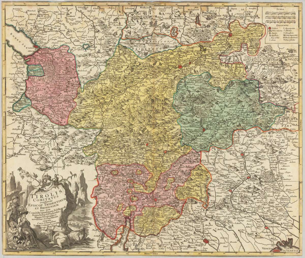
Tirolis Comitatus continens Episcop. Tridentinum et Brixiensem nec non Comit Brigantinum, Feldkirch Sonneberg et...
€325.00
Prices incl. VAT plus shipping costs
This item is sold. Please contact us if you are searching for this item.
Eigenschaften
- Published: Augsburg
- Published date: 1761
- Technique: Copper engraving / Original color.
- Type: map
- Issue date: 1761
- Category: Tirol with Brixen and Trient
- Size: 487 by 576mm (19¼ by 22¾ inches).
- Stock number: 23778
- Condition: In very good condition.
Article description
Article description
Copper engraving, hand colored in outline and wash when published. A decorative and detailed antique map of Tirol with the city of Meran in the centre of the map. The map shows the Austrian county Tirol from Kufstein towards the ,Lago de Garda' with the cities Arco and Gards in the south. It further includes Feldkirch in the west and extends towards Venice in the east. With many small engraved place names, castles, monastries, rivers, lakes, mountains, etc. A small mileage scale in the upper right corner with a table of explanations and a large fine egraved decorative allegoric title cartouche in the lower left corner. Tobias Conrad Lotter was married in 1740 to the oldest daughter of Matthäus Seutter, after Seutter's death in 1757 the printing house passed over to him. He engraved and published maps on his own, further he had then an additional enormous stock of printing plates from Mätthäus Seutter's printing house. From 1757/58 on he changed all Seutter imprints to his name T.C. Lotter. The upper margin with some light stains, the map is cut close to the engraved border of the map, published in an 18th century composite atlas. A clear and strong impression in beautiful hand colors.You might also be interested in the following products
 Elegantissimus a...
 Original antique hand colored copper engraving, published in volume V of the townbooks "Civitates Orbis Terrarum" by...
€850.00
 Prospectus...
 Original antiqu copper engraving, uncolored, published in volume V of the townbooks "Civitates Orbis...
€395.00
 Archiducatus...
 Copper-engraving, handcolored in wash and outline when published. A strong impression. Decorative map of the...
€340.00
 Austriae Descrip....
 Original antique copper engraving, published 1598 in a French text edition of the 'Theatrum Orbis...
€480.00
Recently viewed products