Meyer, Joseph
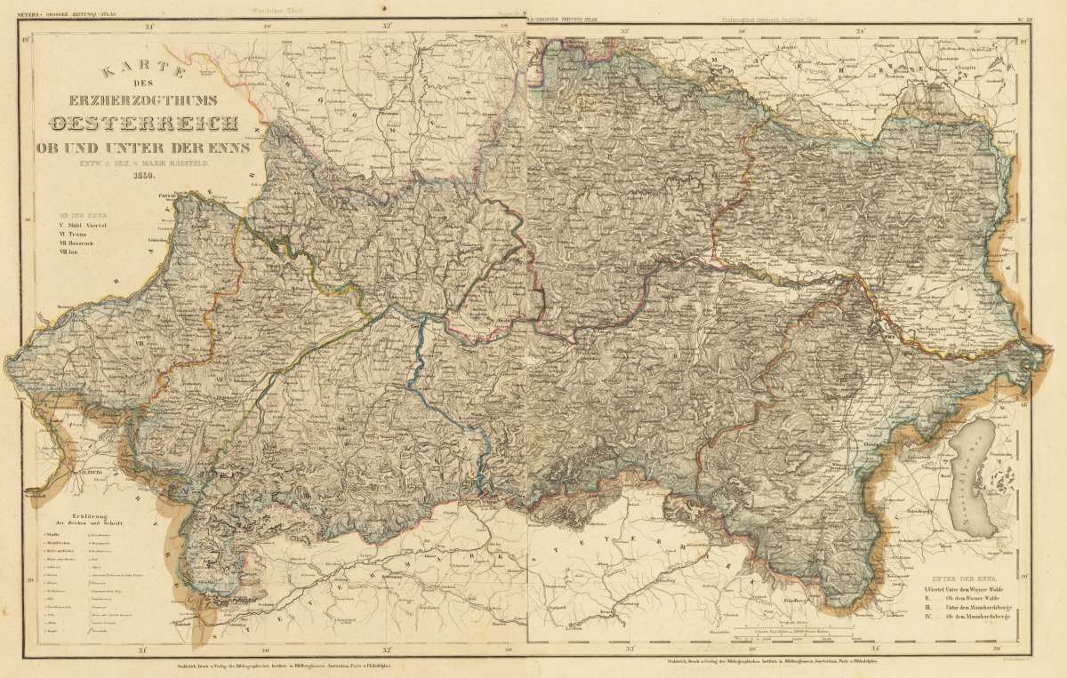
Karte des Erzherzogthums Oesterreich ob und unter der Enns, entw. u. gez. v. Major Radefeld. Westlicher und...
€145.00
Prices incl. VAT plus shipping costs
This item is sold. Please contact us if you are searching for this item.
Eigenschaften
- Published: Hildburghausen
- Published date: 1844
- Technique: Steel engraving, original color
- Type: map
- Issue date: 1844-50
- Category: Unter der Enns
- Size: 365 by 295mm (14¼ by 11½ inches).
- Stock number: 30533
- Condition: In excellent condition. Two parts.
Article description
Article description
Original antique steel engraving, handcolored in outline when published. Decorative detailled engraved map showing the area 'Unter Der Enns' in 'lower Austria' around 1844-50. 'Unter Der Enns' is divided up in four regions: I. Viertel unter dem Wiener Walde - II. Ob dem Wiener Walde - III. Unter dem Mannhardsberge. - IV. Ob dem Mannhardsberge. - V. Mühl Viertel - VI. Traun - VII. Hausruck - VIII. Inn. The map reaches from Burghausen in the west towards Hainburg at the Hungarian border. The north is with the border to Moravia and in the south with the neighbouring Steyrmark. Many details in the engraved map like small villages, rivers, mountains, streets, etc.You might also be interested in the following products
 Elegantissimus a...
 Original antique hand colored copper engraving, published in volume V of the townbooks "Civitates Orbis Terrarum" by...
€850.00
 Prospectus...
 Original antiqu copper engraving, uncolored, published in volume V of the townbooks "Civitates Orbis...
€395.00
 Archiducatus...
 Copper-engraving, handcolored in wash and outline when published. A strong impression. Decorative map of the...
€340.00
 Austriae Descrip....
 Original antique copper engraving, published 1598 in a French text edition of the 'Theatrum Orbis...
€480.00
Recently viewed products