Prices incl. VAT plus shipping costs
This item is sold. Please contact us if you are searching for this item.
- Published: Antwerpen
- Published date: 1590
- Technique: Copper engraving / later hand colored.
- Issue date: 1590
- Category: Franken, Nurnberg with surrounding
- Type: map
- Size: 310 by 238mm (12 by 9 inches).
- Bibliography: Broe. 99; Koe. Ort. 25;
- Stock number: 30443
- Condition: Schönes Exemplar dieser Karte. In ausgezeichnetem Zustand. Rückseitig ohne Text.
Article description
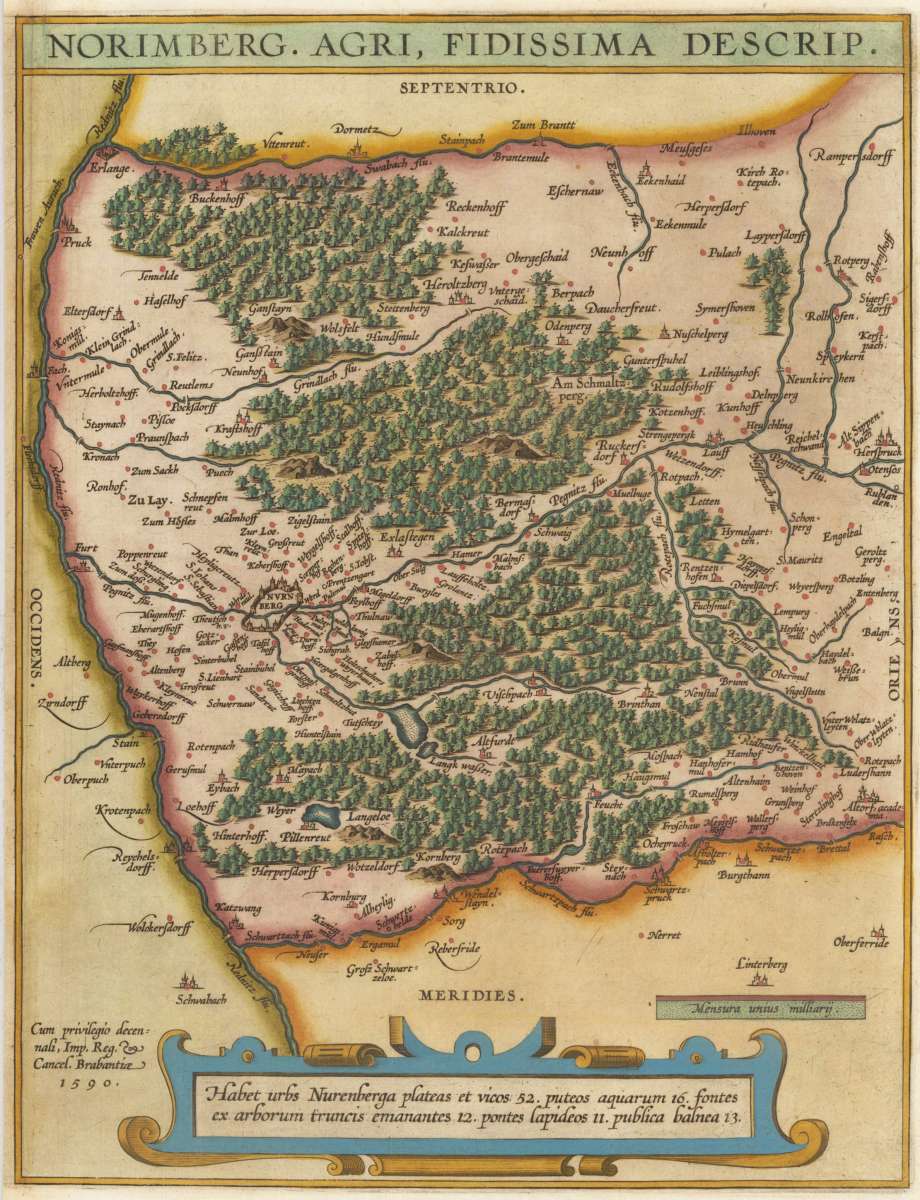
Original antique copper engraving, hand colored The Nuremberg area is shown. In the north the map extends to Erlangen / Uttenreuth and in the south to Schwarzach. In the upper margin is the title, Norimberg. Agri, fidissima descrip. 'And below the map there is a large, painted scrollwork cartridge and privilege. In the west, the map extends from the Rednitz to Hersbruck in the east. Locations, forests, rivers, lakes, etc. were decoratively worked out. Dargestellt wird das Nürnberger Gebiet. Im Norden reicht die Karte bis Erlangen/ Uttenreuth und im Süden bis zur Schwarzach. Im Oberrand ist der Titel,Norimberg. Agri, fidissima descrip.' und unterhalb der Karte befindet sich eine große ausgemalte Rollwerkskartusche nebst Privileg. Im Westen reicht das Kartenbild von der Rednitz bis nach Hersbruck im Osten. Ortsangaben, Wälder, Flüsse, Seen, etc. wurden dekorativ herausgearbeitet.
Norimberg. Agri, fidissima descrip.
Broe. 99; Koe. Ort. 25;
You might also be interested in the following products
 Circulus...
  Die Ludwigsbrücke...
  Der Dom zu Bamberg.
  Schleusse am...