Ortelius, Abraham
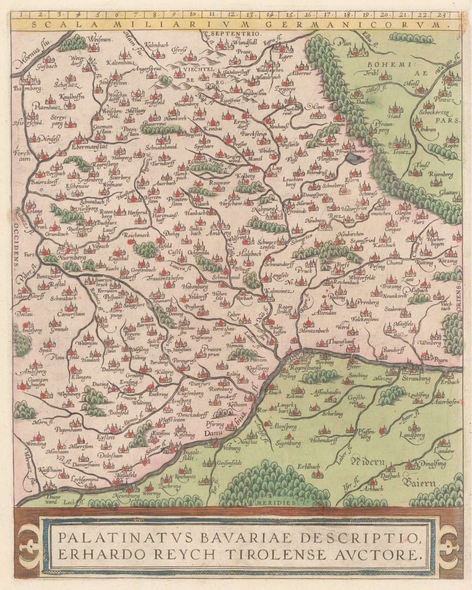
Palatinatus Bavariae Descriptio, Erhardo Reych Tirolense Auctore
Prices incl. VAT plus shipping costs
This item is sold. Please contact us if you are searching for this item.
- Published: Antwerp
- Published date: 1584
- Technique: Copper engraving / later handcolor
- Category: Oberpfalz
- Issue date: 1584
- Type: map
- Size: 304 by 238mm (12 by 9 inches).
- Bibliography: Broe. 112.
- Stock number: 33080
- Condition: In excellent condition.
Article description
Original antique copper engraving in decorative hand color in wash and outline, published in the Theatrum Orbis Terrarum by Abraham Ortelius. At the bottom the colored title cartouche. Decorative and fine map of the Palatinatus Bavariae around 1584-1612. The maps shows upper Bavaria with the neighboring Bohemia woods, the Fichtelgebirge and Nürnberg. In the south the course of the Danube. The cartographic source for this map received Ortelius from Erhard Reych. The cities and town on the map still shown as miniature views in form of silhuetes. This version with the cartouche at the bottom was published 1584 for the first time. Ortelius was born on 14 April 1527 in the city of Antwerp, which was then in the Habsburg Netherlands (modern-day Belgium). The Orthellius family were originally from Augsburg, a Free imperial city of the Holy Roman Empire. In 1535, the family had fallen under suspicion of Protestantism. Following the death of Ortelius's father, his uncle Jacobus van Meteren returned from religious exile in England to take care of Ortelius. Abraham remained close to his cousin Emanuel van Meteren, who would later moved to London. In 1575 he was appointed geographer to the king of Spain, Philip II, on the recommendation of Arias Montanus, who vouched for his orthodoxy. He travelled extensively in Europe and is specifically known to have traveled throughout the Seventeen Provinces; in southern, western, northern, and eastern Germany (e.g., 1560, 1575–1576); France (1559–1560); England and Ireland (1576); and Italy (1578, and perhaps twice or thrice between 1550 and 1558). Beginning as a map-engraver, in 1547 he entered the Antwerp Guild of Saint Luke as an illuminator of maps. He supplemented his income trading in books, prints, and maps, and his journeys included yearly visits to the Frankfurt book and print fair, where he met Gerardus Mercator in 1554. In 1560, however, when travelling with Mercator to Trier, Lorraine, and Poitiers, he seems to have been attracted, largely by Mercator's influence, towards the career of a scientific geographer. (Wikipedia)
Broe. 112.
You might also be interested in the following products
 Oberpfalz Nordgau
 Aquarell des...
  Walhalla Ratisbon