Mercator, Gerard
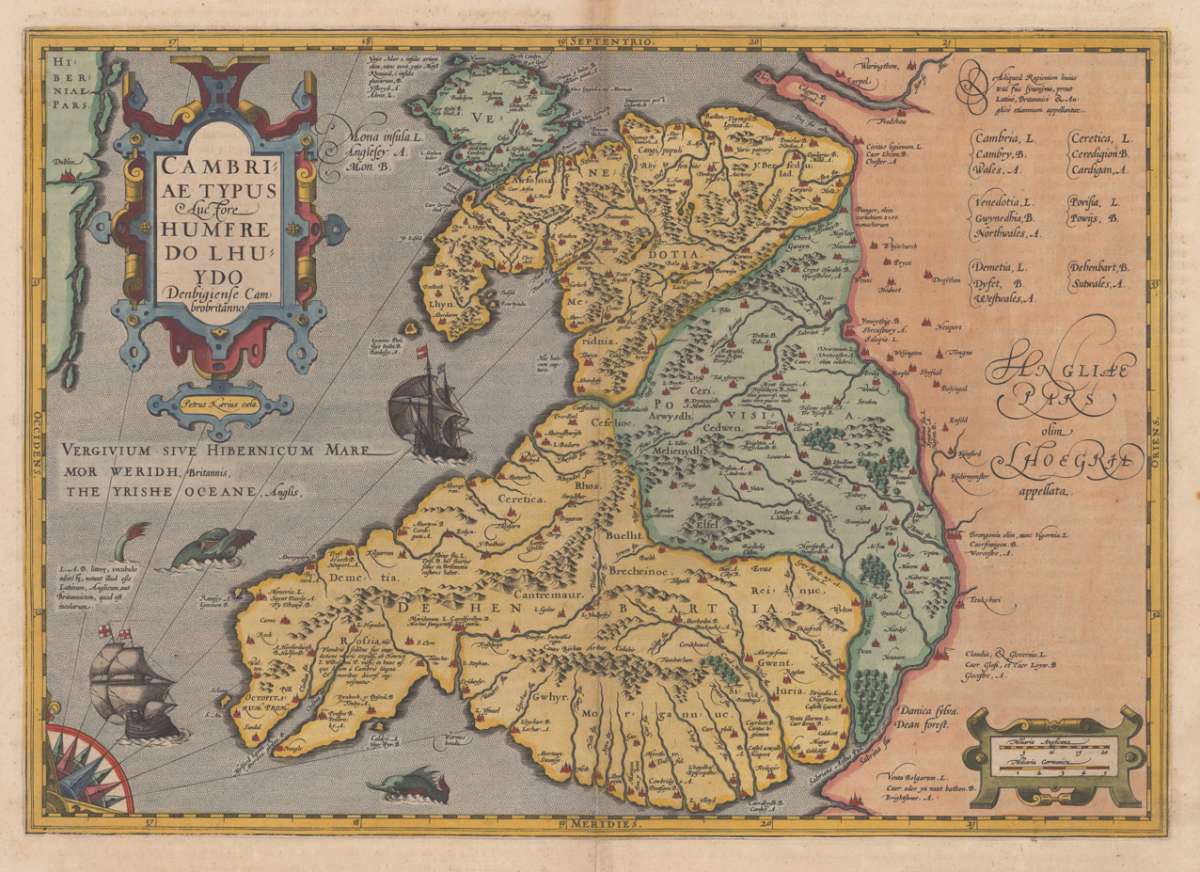
Cambriae Typus Auctore Humere Dolhuydo Denbigiense Cambrobritanno


Prices incl. VAT plus shipping costs
This item is sold. Please contact us if you are searching for this item.
- Published: G. Mercator , Amsterdam
- Published date: 1613
- Type: Antique Map, map
- Technique: Copperengraving/handcolored.
- Issue date: 1613-16
- Category: Wales
- Size: 352 by 500mm (13¾ by 19¾ inches).
- Bibliography: Koeman I [5500:1A.1] 1:112 French text edition
- Stock number: 13048
- Condition: A skillfully tiny split at the lower centre fold. Else in excellent condition.
Article description
Copper engraving, hand colored in outline and wash. Decorative early map of Wales by the famous Dutch cartographer Gerard Mercator ornated with a renaissance title cartouche, a mileage scale, sea-monsters in the ocean and sailing ships. An early historic rare map of Wales published by Gerard Mercator 1613-16 in his atlas ,Atlas sive Cosmographicae Meditationes de Fabrica Mundi et Fabricati Figura. Denuo auctus - edition quarta.'. This rare map was published for the first time in 1607-08 in Gerard Mercator's atlas and appearred in several editions. Our example is from 1613-16 and has verso French descriptive text.
Koeman I [5500:1A.1] 1:112 French text edition
You might also be interested in the following products

 De Custen van...
  Neueste Karte von...
  Anglia Cambdeni,...