Braun, Georg & Hogenberg, Franz
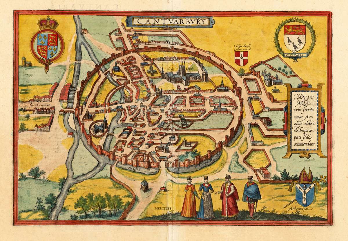
Cantuarbury
Cantuaria urbs fertlissimae Angliae celebris; Archiepiscopati sede, commendata.
€750.00
Prices incl. VAT plus shipping costs
This item is sold. Please contact us if you are searching for this item.
Eigenschaften
- Published: Cologne
- Published date: 1617
- Type: Antique Map, map
- Technique: Copper engraving / later handcolor
- Issue date: 1617
- Category: Canterbury
- Size: 295 by 435mm (11½ by 17¼ inches).
- Stock number: 17476
- Condition: In excellent condition, on the full sheet as published. Latin text edition verso.
Article description
Article description
Original copper-engraving, handcolored in wash, published 1617 in the townbook 'Civitates Orbis Terrarum' by Braun and Hogenberg. The entire series of the 'Civitates Orbis Terrarum' comprised six volumes and was published and printed from 1572 towards 1619. Decorative bird's eye view of Canterbury in the England. The city is shown decorative with its walls. the castle, churches, markets and important buildings are shown. The city views by Braun & Hogenberg are one of the earliest obtainable printed old city views. The map is ornated with three coats of arms in the corners.Cantuaria urbs fertlissimae Angliae celebris; Archiepiscopati sede, commendata.
You might also be interested in the following products

 De Custen van...
 Fascinating detailed seachart of the south-eastern coast of England showing the coastline from Lizard Point over...
€950.00
 Neueste Karte von...
 Steelengraving, handcolored in outline when published. The detailled map of the British Isles is providing a lot of...
€80.00
 Anglia Cambdeni,...
 Original antique copper engraving, hand colored in outline and wash when published. Decorative detailled map...
€195.00
Recently viewed products