(Liesganig)
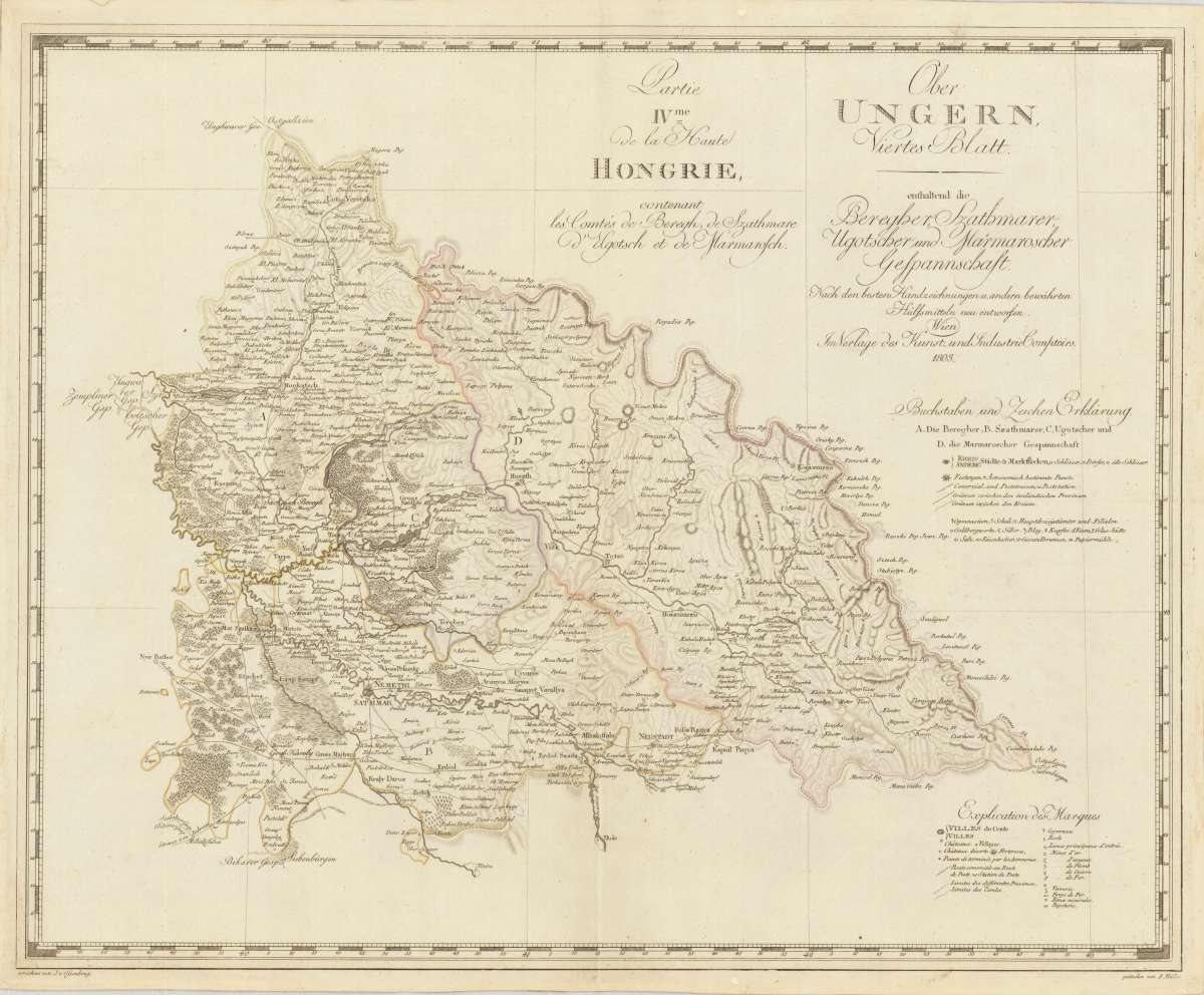
Ober UNGERN, Viertes Blatt. enthaltend die Beregher, Szathmarer, Ugotscher und Marmaroscher Gespannschaft. Nach den...
€175.00
Prices incl. VAT plus shipping costs
This item is sold. Please contact us if you are searching for this item.
Eigenschaften
- Published: Vienna
- Published date: 1803
- Technique: Copper engraving / Original color.
- Issue date: 1803
- Type: map
- Category: Upper Hungary
- Size: 467 by 580mm (18½ by 22¾ inches).
- Stock number: 27142
- Condition: The map is mounted on publisher's linen and was folded twice. The old folds are minor visible. In very good to excellent condition.
Article description
Article description
Copper engraving, hand colored in outline when published. Detailed map of upper Hungary with Sathmar, Nemethi, Huszth and Sigth in its centre. The map provides detailed fine engraved information on place names, rivers, mountains, woods, etc. At the bottom of the map with a detailed explanation in German and French language.You might also be interested in the following products
 The Bloxberg
 Original steel engraving, engraved by C. Cousen after W.H. Bartlett. Decorative, romantic view from Pesth over the...
€45.00
 City of Buda, or...
 Original steel engraving, engraved by R. Wallis after W.H. Bartlett. Decorative, romantic view towards Budapest.
€50.00
 Buda and Pesth...
 Original steel engraving, engraved by G.K. Richardson after W.H. Bartlett. Decorative, romantic panorama city-view...
€50.00
 Procession of...
 Original steel engraving, engraved by E. Brandard after W.H. Bartlett. Decorative, romantic scene showing a...
€45.00
Recently viewed products