Münster, Sebastian
Von Teutsch Landt. Oysterreich
€60.00
Prices incl. VAT plus shipping costs
This item is sold. Please contact us if you are searching for this item.
Eigenschaften
- Published: Basel
- Published date: 1574
- Issue date: 1574
- Technique: Woodcut, later hand colored.
- Type: map
- Category: Illyria and Carniola
- Size: 300 by 165mm (11¾ by 6½ inches).
- Stock number: 31403
- Condition: On the full text sheet, in excellent condition.
Article description
Article description
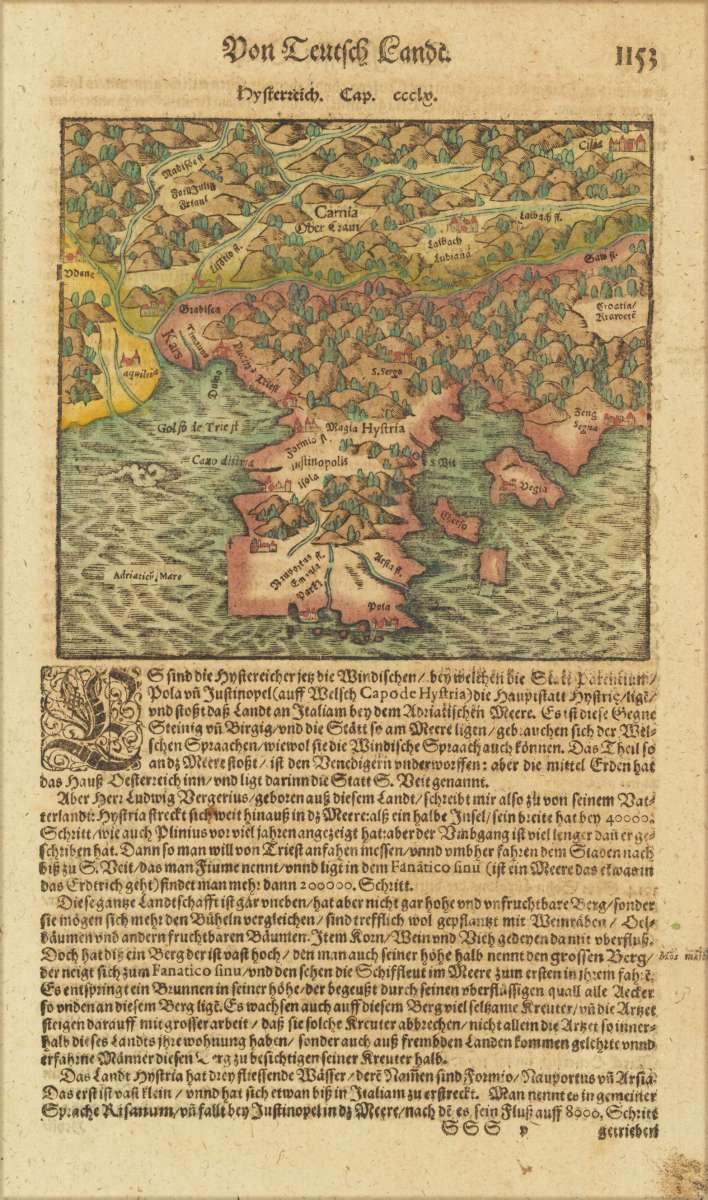
Woodcut map, finely hand colored in wash by a later hand. Published in the ,Cosmographia' by Sebastian Münster in Basel, German text edition 1574. Early and decorative woodcut map of the regions in Carniola, Slovenia, Illyria and the neighboring Croatia. Mountain chains, woods and very few place names are schematic shown on this old historic map. An interesting historic 16th century map of the region around Illyria and the gulf of Triest. This fine antique map was was published 1574 in a German text edition of Sebastian Münster's ,Cosmographia', the first detailed scientific and popular description of the world in Sebastian Münster's native language as well as a supreme effort of geographical study and literature of the Reformation period. One of the most popular treatises of the sixteenth and seventeenth centuries the Cosmographia reached a total of forty-six editions in six languages by 1650 each incorporating additions and revisions. Sebastian Münster was a professor of Hebrew at Basel university and a most distinguished Hebraist linguist mathematician and geographer. This encyclopedic work was his major undertaking. In its completion, which occupied him for fifteen years, Münster received the assistance of more than one hundred and twenty collaborators, who provided him with the most up-to-date information relating to the towns and places described. The scientifically most valuable sections are those which deal with Germany and Central Europe.You might also be interested in the following products
 Elegantissimus a...
 Original antique hand colored copper engraving, published in volume V of the townbooks "Civitates Orbis Terrarum" by...
€850.00
 Prospectus...
 Original antiqu copper engraving, uncolored, published in volume V of the townbooks "Civitates Orbis...
€395.00
 Rhetiae alpestris...
 Original copper engraving, published 1612 in the famous Vrients-edition of the "Theatrum Orbis Terrarum"....
€440.00
 Archiducatus...
 Copper-engraving, handcolored in wash and outline when published. A strong impression. Decorative map of the...
€340.00
Recently viewed products