Diewald, Joh. Nep.
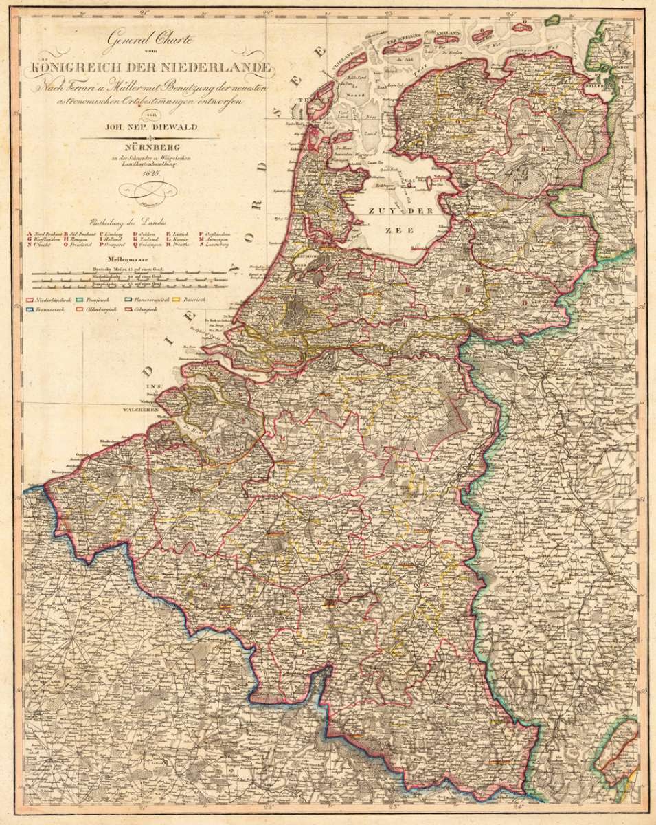
General Charte vom Königreich der Niederlande Nach Ferrari u. Müller mit Benutzung der neuesten...
€245.00
Prices incl. VAT plus shipping costs
This item is sold. Please contact us if you are searching for this item.
Eigenschaften
- Published: Schneider und Weigelsche Landkartenhandlung , Nürnberg
- Published date: 1825
- Type: Antique Map, map
- Issue date: 1825
- Technique: Copper engraving / Original color
- Category: Niederlande
- Size: 674 by 530mm (26½ by 20¾ inches).
- Stock number: 29364
- Condition: In very good condition. 674 by 530mm (26½ by 20¾ inches).
Article description
Article description
Copper engraving, hand colored in outline when published A highly detailed map of the kingdom from Netherlands with Antwerpen in the centre of the map. The map provides a relativ large scale on this region and includes detailed information on place names, villages, mountains, rivers, woods, etc. In the left upper corner is the cartouche with the milescale. On the right side of the map is the border to Germany. In the lower left corner are parts of France shown.You might also be interested in the following products
 Tienen. - Tiena
 Copper engraving, uncolored as published in the townbook "Civitates Orbis Terrarum" by Georg Braun and...
€300.00
 Bergen op Zoom
 Original copper engraving, published ca. 1588 in volume III of the town book 'Civitates Orbis Terrarum' by...
€395.00
 Duynkercke. -...
 Original copper engraving, hand colored in wash, published 1578 in the townbook 'Civitates Orbis Terrarum' by Braun...
€395.00
 Gelriae, Cliviae,...
 Original antique copper engraving, published 1612 in a Italian text edition of the 'Theatrum Orbis...
€495.00
Recently viewed products