Straube, J.
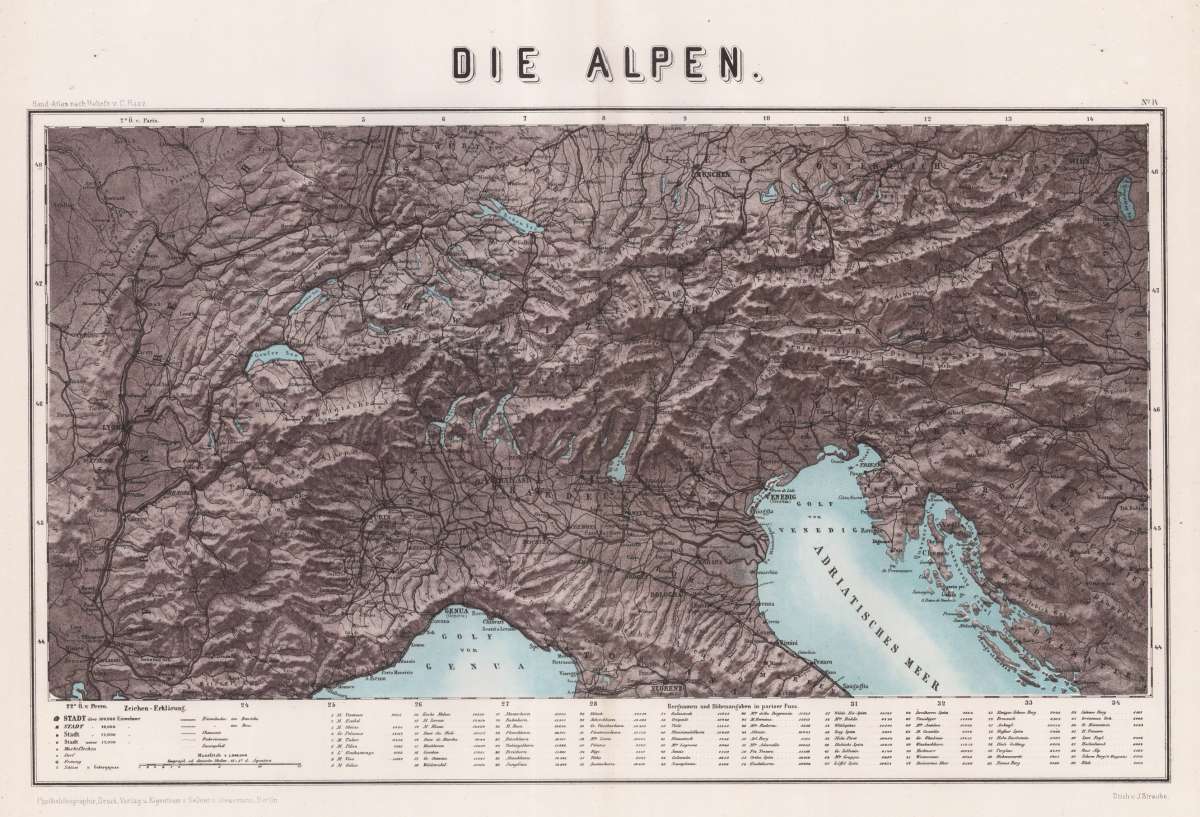
Die Alpen
Prices incl. VAT plus shipping costs
Free of shipping costs!
This item is sold. Please contact us if you are searching for this item.
- Published: Berlin
- Published date: 1870
- Type: map
- Category: Rivers and Mountains
- Technique: Original Farblithographie.
- Issue date: 1866-70
- Size: 32 x 54 cm (12,5 x 21.25 inches).
- Stock number: 34373
- Condition: In very good condition, with a small rip on the lower right side.
Article description
Original Lithograph, printed in colors. Map of the Alps by J. Straube. Depicted are the Alps with the Gulf of Venice and the Gulf of Genua. On the left side is the french part, in the lower middle the italian part, in the upper middle the german and austrian part and on the right side are Hungary, Croatia and the Turkey. City and place names as well as rivers, lakes and other bodies of water are listed in detail, as well as the military lines. Below the map is an explanation of symbols in German as well as the mountain items and altitude information in Parisian feet. Scale 1: 1,984,000 in German miles.
You might also be interested in the following products
 Dr. Th. Kotschy´s...
  Von Teutsch...
 A comparative...