Homanns Heirs
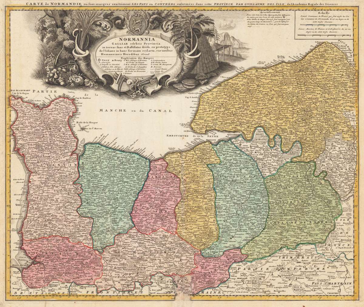
Carte de Normandie ou sont marquez exactement Les Pays ou Contrees... Homannianis Heredibus Norimb.
€85.00
Prices incl. VAT plus shipping costs
This item is sold. Please contact us if you are searching for this item.
Eigenschaften
- Published: Nürnberg
- Published date: 1741
- Technique: Copper engraving / Original color.
- Issue date: 1741
- Type: map
- Category: Holy-Roman-Empire
- Size: 48.4 x 58 cm (19 x 22,75 inches).
- Stock number: 34566
- Condition: In good condition, only a few minor damages/page losses at the bottom of the center fold.
Article description
Article description
Original copper engraving, hand colored in outline and wash when published. Early 18th century map from an atlas (central fold). Beautiful allegorical cartouche (plowing implements and agricultural production) surmounted by the arms of Normandy.You might also be interested in the following products
 Pastor Bonus
 Copper engraving, published and printed in the Netherlands probably around 1700-50. Engraved by or after C. Galle.
€90.00
")
")
 Jupiter et Danae
 Farbradierung in Crayon-Manier, nach François Boucher. Original engraving in colours in crayon-manor, an excellent...
€489.99
Recently viewed products