Tallis, J & F.
Northern Africa
Eigenschaften
- Published: John Tallis & Company , London & New York
- Published date: 1851
- Type: Antique Map, map
- Issue date: 1851
- Category: North Africa
- Technique: Steel engraving, hand colored.
- Size: 25 by 33mm (1 by 1¼ inches).
- Stock number: 29631
- Condition: In excellent condition.
Article description
Article description
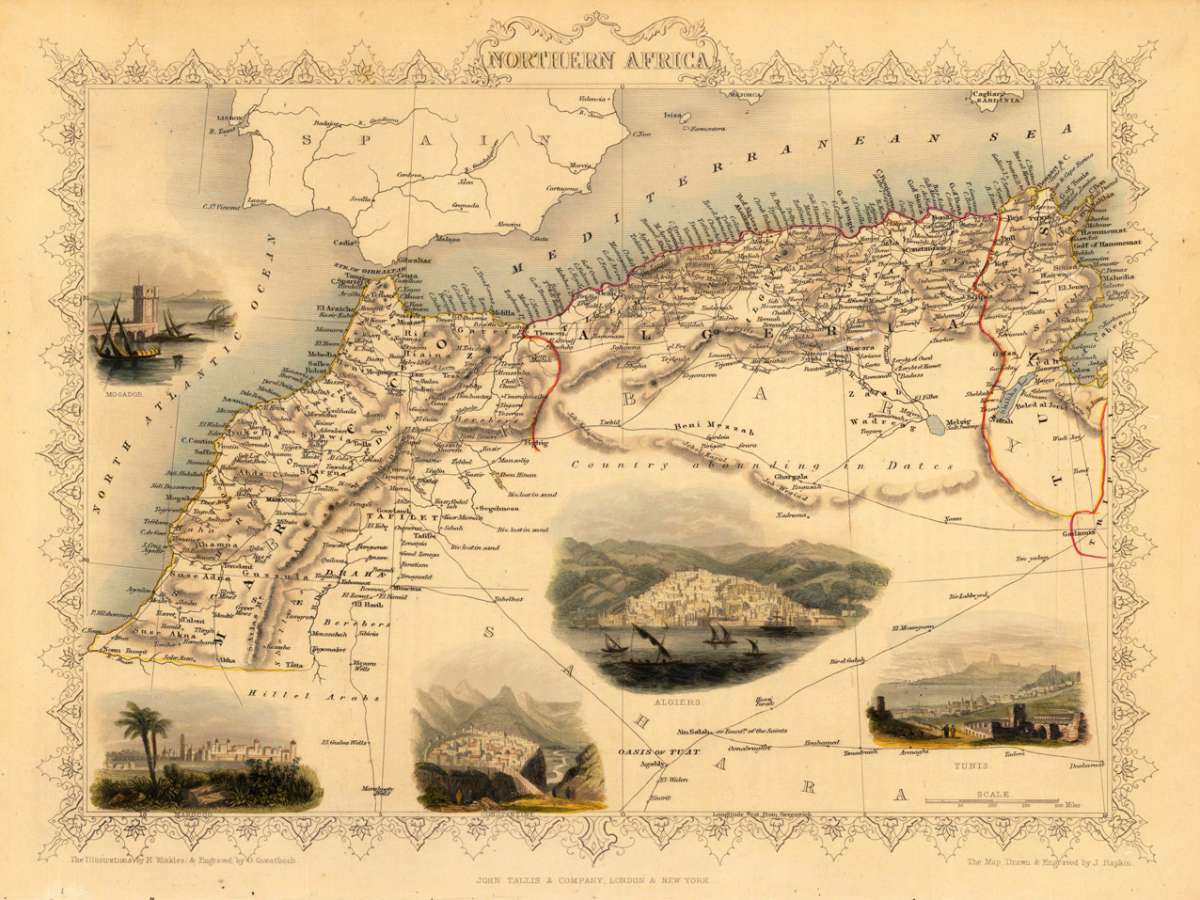
Steel engraving, hand colored in outline and wash. Fine engraved map is showing Northern Africa, the Mediterranean Sea and the North Atlantic Ocean. The map is decorated with five finely hand colored engraved vignettes: the city views of Tunis, Algiers, Constantine, Marocco and the port of Mogador. The actual map was drawn and engraved by J. Rapkin. The illustrations were engraved by various artists: R. Radclyffe, W. Lacy, J. Rogers, J. H. Kernot, J. B. Allen, T. Fleming, H. Winkles, R. Baker after drawings by H. Warren, H. Winkles and H. Wray.You might also be interested in the following products
 Etats du Roi de...
 Original antique copper engraving, uncolored as published. Two interesting maps of North Africa on 1 double page...
€80.00
 Neueste Karte von...
 Steel engraving, in original colors, as published. A detailed map of Tunisia with many place names inland and along...
€80.00
 Neueste Karte von...
 Steel engraving, in original colors, as published. A detailed map of Nubia and Habesch with the Red Sea.
€60.00
 Pascaert van de...
 Original antique copper engraving, uncolored as published. Johannes van Keulen (1654 in Deventer – 1715 in...
€850.00
Recently viewed products