Jansonnius, Joan.
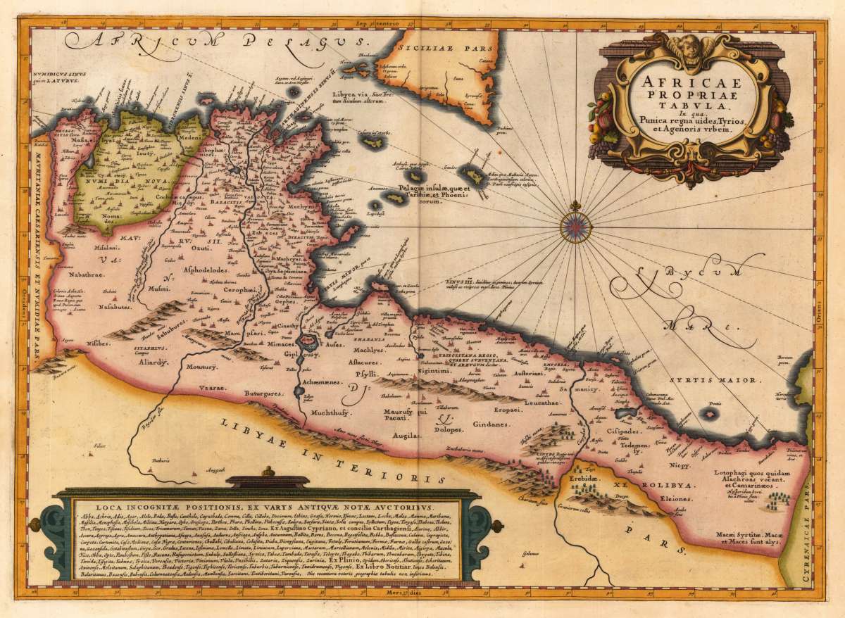
Africae Propriae Tabula. In qua, Punica regna uides, Tyrios, et Agenoris urbem
- Published: Amsterdam
- Published date: 1662
- Issue date: 1662
- Technique: Copper engraving / later hand color
- Category: Northern Africa
- Type: map
- Size: 375 by 520mm (14 by 20 inches).
- Bibliography: Koeman I / 8610H:1
- Stock number: 30047
- Condition: In excellent condition. 375 by 520mm (14 by 20 inches).
Article description
Copper engraving, hand colored in wash and outline, published in a Dutch text edition of J. Jansson's historical Atlas, verso blank. Decorative map showing the North African coast (Tunesia), Malta and its neighbouring islands and a parts of Sicily. Ornated in the upper right corner with a large decorative title cartouche and on the bottom an extensive cartouche with descriptive text about old place names in Latin. Johannes Janssonius (1588, Arnhem – buried July 11, 1664, Amsterdam) (born Jan Janszoon, in English also Jan Jansson) was a Dutch cartographer and publisher who lived and worked in Amsterdam in the 17th century. Janssonius was born in Arnhem, the son of Jan Janszoon the Elder,[1] a publisher and bookseller. In 1612 he married Elisabeth de Hondt, the daughter of Jodocus Hondius. He produced his first maps in 1616 of France and Italy. In 1623 Janssonius owned a bookstore in Frankfurt am Main, later also in Danzig, Stockholm, Copenhagen, Berlin, Königsberg, Geneva and Lyon. Elisabeth Hondius died in 1627 and he remarried Elisabeth Carlier in 1629. In the 1630s he formed a partnership with his brother in law Henricus Hondius, and together they published atlases as Mercator/Hondius/Janssonius. Under the leadership of Janssonius the Hondius Atlas was steadily enlarged. Renamed Atlas Novus, it had three volumes in 1638, one fully dedicated to Italy. In 1646, a fourth volume came out with "English County Maps", a year after a similar issue by Joan Blaeu. Janssonius' maps are similar to those of Blaeu, and he is often accused of copying from his rival, but many of his maps predate those of Blaeu and/or covered different regions. By 1660, at which point the atlas bore the appropriate name "Atlas Major", there were 11 volumes, containing the work of about a hundred credited authors and engravers. It included a description of "most of the cities of the world" (Townatlas), of the waterworld (Atlas Maritimus in 33 maps), and of the Ancient World (60 maps). The eleventh volume was the Atlas of the Heavens by Andreas Cellarius. Editions were printed in Dutch, Latin, French, and a few times in German. After Janssonius's death, the publishing company was continued by his son-in law, Johannes van Waesbergen. The London bookseller Moses Pitt attempted publication of the Atlas Major in English, but ran out of resources after the fourth volume in 1683. (Wikipedia)
Koeman I / 8610H:1
You might also be interested in the following products
 Aegypti Tabula
  Etats du Roi de...
  Neueste Karte von...
  Neueste Karte von...