Renard, Louis
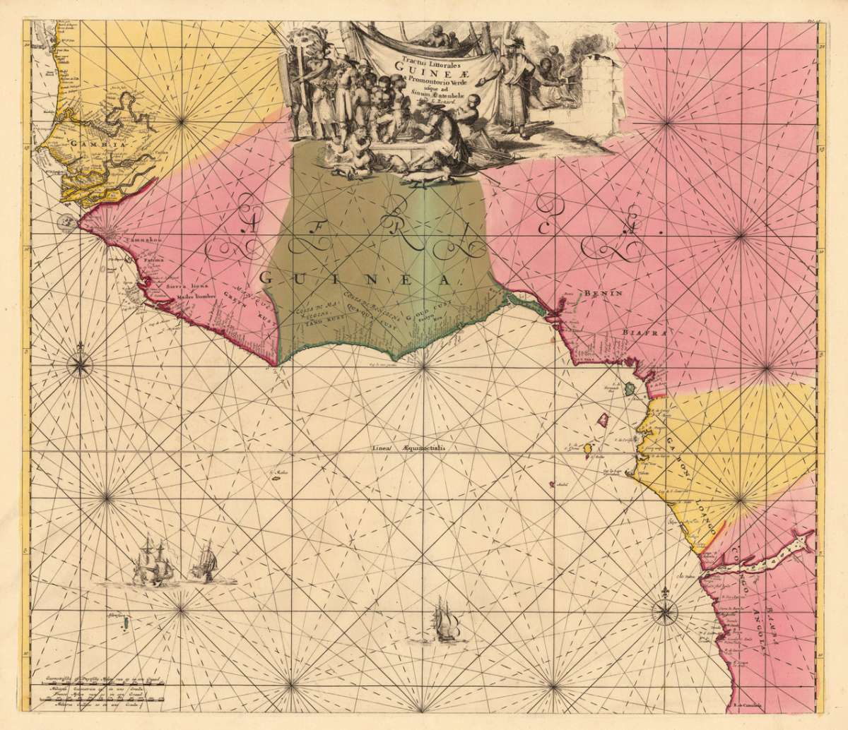
Tractus Littorales Guineae a Promontorio Verde usque ad Sinum C. atenbelae Apud L. Renard
Eigenschaften
- Published: Amsterdam
- Published date: 1700
- Technique: Copper engraving / Original color.
- Category: Guinea
- Issue date: 1700
- Type: map
- Size: 490 by 569mm (19¼ by 22½ inches).
- Stock number: 18827
- Condition: In excellent condition.
Article description
Article description
Copper engraving, hand colored in outline and wash when published. A fine and large and decorative sea chart depicting West Africa with its coastline from Gambia in the north towards Angola and the Congo in the southern part. The antique sea chart is equipped with two compass roses and three sailing ships for decoration. Along the coastline with engraved bays, place names and small islands. This rare map was published around 1700 in Louis Renard's famous sea-atlas. Louis Renard received the copperplates of Frederic De Wit´s maritime atlas. Louis Renard did only minor modifications to the plate of map, he added ,apud L. Renard' below the engraved titles.
You might also be interested in the following products
 Guinea propia,...
 Original antique copper engraving, hand colored in outline and wash when published. This antique map shows Guinea...
€445.00
 Paskaart Van de...
 Original antique copper engraving, uncolored as published. Decorative early sea chart, orientated with the North to...
€395.00
 Neueste Karte von...
 Steel engraving, hand colored in outline when published. This interesting map shows Sudan and Guinea in West Africa....
€80.00
 Pascaert vande...
 Original antique copper engraving, uncolored as published. This decorative sea chart shows Benin in West Africa....
€495.00
Recently viewed products