Bellin, Nicolaus
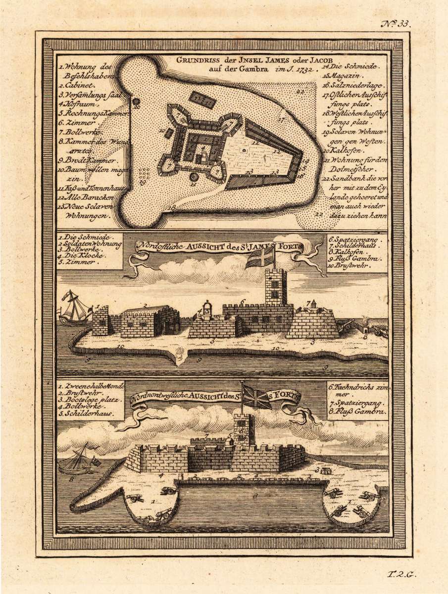
Grundriss der Insel James oder Jacob auf der Gambra im J. 1732. - Nordostliche Aussicht des St. James Forts. -...
Eigenschaften
- Published: Merkur , Leipzig
- Published date: 1748
- Type: Antique Map, map
- Technique: Copper engraving / Uncolored
- Issue date: 1748
- Category: Island James in Gambra
- Size: 190 by 136mm (7½ by 5¼ inches).
- Stock number: 19039
- Condition: In excellent condition. 190 by 136mm (7½ by 5¼ inches).
Article description
Article description
Copper engraving, uncolored as published. This decorative map shows a ground plan from the island of St. James. The map has three parts on the map. One shows the ground plan of the island St. James, one the Northeast view from the St. James forts and the third the North-northwest view of the St. James fort. A fine detailed and interesting map engraved by Bellin after earlier voyages. Published in the German edition by Schwabe in Leipzig of Bellin's travel books.You might also be interested in the following products
 Guinea propia,...
 Original antique copper engraving, hand colored in outline and wash when published. This antique map shows Guinea...
€445.00
 Paskaart Van de...
 Original antique copper engraving, uncolored as published. Decorative early sea chart, orientated with the North to...
€395.00
 Neueste Karte von...
 Steel engraving, hand colored in outline when published. This interesting map shows Sudan and Guinea in West Africa....
€80.00
 Pascaert vande...
 Original antique copper engraving, uncolored as published. This decorative sea chart shows Benin in West Africa....
€495.00
Recently viewed products