Radefeld, Hauptmann von
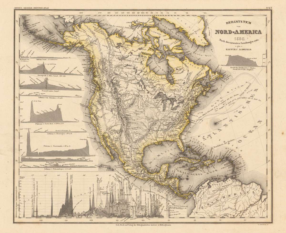
Bergsystem von Nord-America 1850. Nach den neuesten Forschungen entw. u. gez. v. Hauptm. C. Radefeld.
Eigenschaften
- Published: Bibliograph. Institut , Hildburghausen
- Published date: 1850
- Type: Antique Map, map
- Technique: Steel engraving, original color
- Issue date: 1850
- Category: North America (Mountain System)
- Size: 300 by 358mm (11 by 14 inches).
- Stock number: 16927
- Condition: In excellent condition. 300 by 358mm (11 by 14 inches).
Article description
Article description
Original steel-engraving, hand colored in outline, when published. Detailed fine map of North-America s mountain system, engraved after Hauptmann Radefeld. This fine engraved map shows probably all known mountains at this time in North America. The main rivers are as well shown with the chains of the mountains. The left side of the map is ornated with various insets of profiles of mountain plateaus of North- and Central America. At the bottom of the map we find a diagram to compare the various heights of the mountains in North America.You might also be interested in the following products
 Amerique...
 Copper engraving, hand colored in outline and wash when published. Fine engraved map of the state of North America...
€480.00
 America...
 Copper engraving, hand colored in wash when published. This map of North America published by G. Tasso in Venice is...
€475.00
 L' America...
 Copper engraving, hand colored in wash when published. These two maps are showing North and South America. They...
€160.00
 Flusskarte von...
 Steel engraving, hand colored in outline and wash when published. The two maps are showing detailed river maps of...
€48.00
Recently viewed products