Philip, George & Son
North America
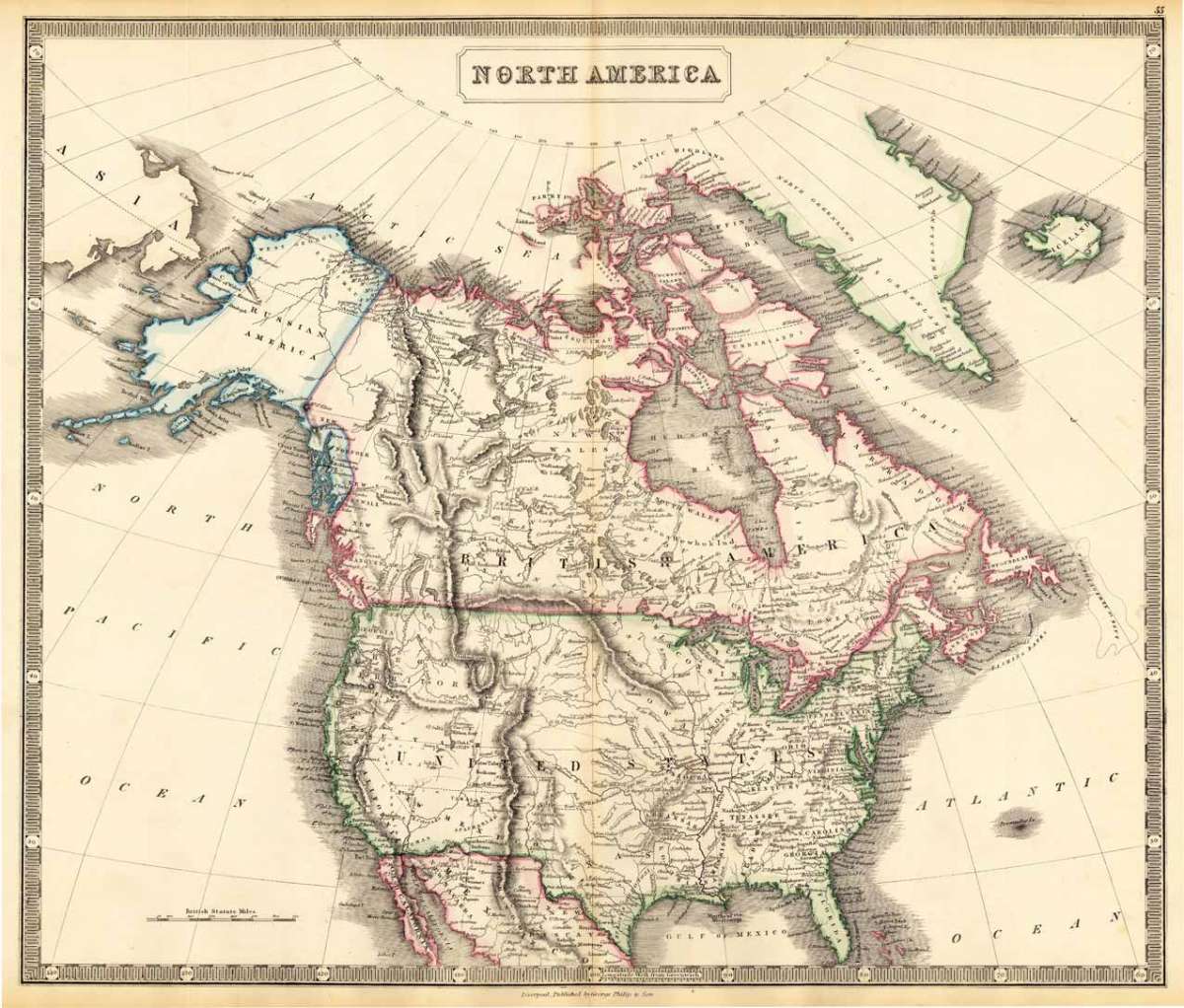
Eigenschaften
- Published: Philip & Son , Liverpool
- Published date: 1852
- Type: Antique Map, map
- Category: North America
- Technique: Lithograph / Original color.
- Issue date: 1852
- Size: 510 by 600mm (20 by 23 inches).
- Stock number: 17031
- Condition: In excellent condition. 510 by 600mm (20 by 23 inches).
Article description
Article description
Lithograph, original hand colored in outline. Decorative double page hand colored map, showing impressive North America around 1852. The map begins in the east in Newfoundland and reaches towards Russian America (Alaska) with the Bering Street. In the South with Florida and Texas. In the west with some notes on Indian territories and Wagon routes.You might also be interested in the following products
 Amerique...
 Copper engraving, hand colored in outline and wash when published. Fine engraved map of the state of North America...
€480.00
 America...
 Copper engraving, hand colored in wash when published. This map of North America published by G. Tasso in Venice is...
€475.00
 L' America...
 Copper engraving, hand colored in wash when published. These two maps are showing North and South America. They...
€160.00
 Flusskarte von...
 Steel engraving, hand colored in outline and wash when published. The two maps are showing detailed river maps of...
€48.00
Recently viewed products