Bonne, Rigobert
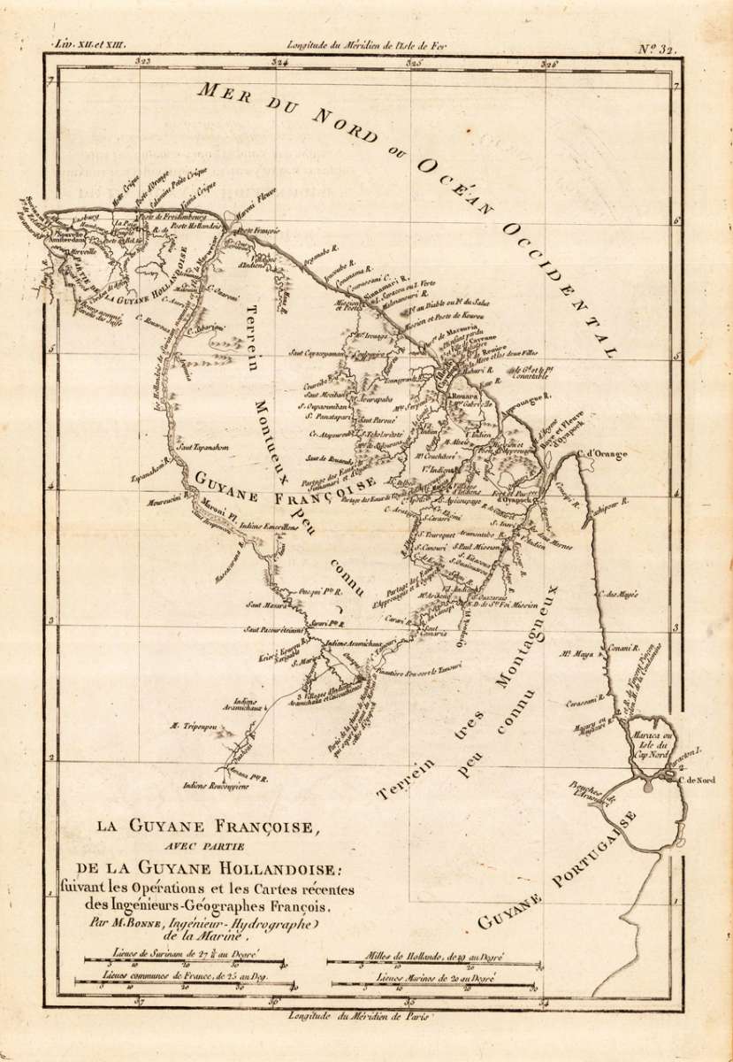
La Guyane Francoise, avec partie de la Guyane Hollandoise; fuivant les Opérations et les Cartes récentes des...
Eigenschaften
- Published: M. Bonne , Paris
- Published date: 1787
- Type: Antique Map, map
- Technique: Copper engraving / Uncolored
- Issue date: 1787-88
- Category: French Guiana
- Size: 319 by 215mm (12 by 8 inches).
- Stock number: 18461
- Condition: In excellent condition.
Article description
Article description
Original antique copper engraving, uncolored as published. This antique map shows French Guinea with many place names, rivers and engraved mountains. At the bottom is an engraved mileage scale. Rigobert Bonne (6 October 1727 – 2 September 1794) was a French cartographer, widely considered to be one of the most important cartographers of the late 18th century. In 1773 Bonne succeeded Jacques Nicolas Bellin as Royal Cartographer to France in the office of the Hydrographer at the Depôt de la Marine. Working in his official capacity, Bonne compiled some of the most detailed and accurate maps of the period. Bonne's work represents an important step in the evolution of the cartographic ideology away from the decorative work of the 17th and early 18th century towards a more detail oriented and practical aesthetic. With regard to the rendering of terrain Bonne maps bear many stylistic similarities to those of his predecessor, Bellin. However, Bonne maps generally abandon such common 18th century decorative features such as hand coloring, elaborate decorative cartouches, and compass roses. While mostly focusing on coastal regions, the work of Bonne is highly regarded for its detail, historical importance, and overall aesthetic appeal. (Wikipedia)You might also be interested in the following products
 Pas kaart Vande...
 Original antique copper engraving, finely hand colored in outline and wash, probably later hand color. Detailed...
€600.01
 Guiana fiue...
 Copper engraving, hand colored in outline when published. A highly decorative map showing Guiana with the...
€400.00
 Der Stadt Cayenne...
 Copper engraving, uncolored as published. Detailled map showing the fortified city Cayenne in French Guiana. With...
€55.00
 Die Ludtwigs...
 Copper-engraving, handcolored in wash and outline. This antique map shows us the fortress of Louisbourg as a bird´s...
€86.00
Recently viewed products