Prices incl. VAT plus shipping costs
This item is sold. Please contact us if you are searching for this item.
- Published: Venice
- Published date: 1778
- Technique: Copper engraving / Original color.
- Issue date: 1778.
- Category: Jamaica
- Type: map
- Size: 335 by 440mm (13¼ by 17¼ inches).
- Stock number: 12929
- Condition: In very good to excellent condition, minor browned middle-fold (gluestaining), as often.
Article description
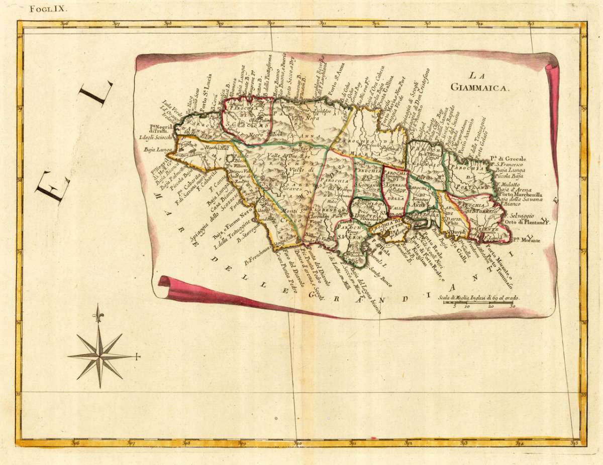
Copper engraving, in contemporary original color in outline. Published in Zatta's "Atlante Novissimo". A decorative antique map of Jamaica, published in Zatta's 'Atlante Novissimo' as sheet IX in his twelve-sheet map of the United States. An interesting map of Jamaica in the West Indies by the famous Italian cartographer Antonio Zatta. A highly detailed antique map by the famous late 18th century north-italian cartographer Antonio Zatta. With many names of towns and small villages, as well engraved names of mountains, rivers, lakes and also names of Indian tribes are shown on this old historic map. Along the coastline with details of engraved sandbanks, bays and small islands. This map was published in Antonio Zatta's "Atlante Novissimo" as sheet IX of his twelve-sheet map of the United States.
Fogl. IX (Jamaica)
You might also be interested in the following products
 Pas kaart Van de...
  Isle de la...
  Isle De La...
  Martinico to...