Bonne, Rigobert
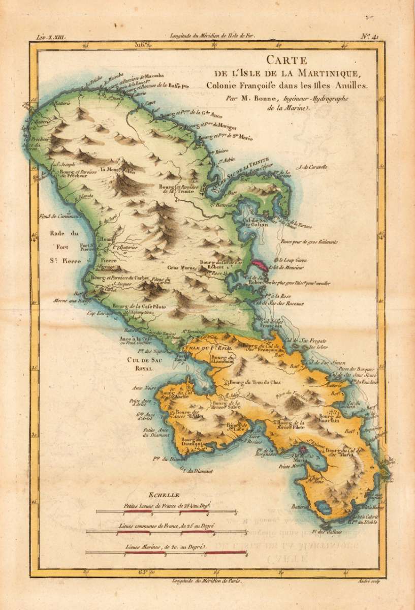
Carte de L' Isle de La Martinique, Colonie Francoise dans les Isles Antilles. Par M. Bonne,...
€95.00
Prices incl. VAT plus shipping costs
This item is sold. Please contact us if you are searching for this item.
Eigenschaften
- Published: M. Bonne , Paris
- Published date: 1771
- Type: Antique Map, map
- Technique: Copper engraving / later hand color
- Issue date: 1771
- Category: Martinique
- Size: 325 by 215mm (12¾ by 8½ inches).
- Stock number: 15446
- Condition: In excellent condition.
Article description
Article description
Copper engraving, hand colored in outline and wash. Detailed map showing the French colony 'Island of Martinique'. Rivers, small villages as well mountains are shown on the engraved map. Engraved by André. Rigobert Bonne (1727-1794) was a French cartographer of the late 18th century. He studied in Paris and practiced cartography. He became a skilled cartographer and hydrographer and became a royal hydrographer at the ,Depot de la Marine' in 1773. In 1780 he engraved and published the maps for Abbe Raynal's work ,Atlas de Toutes Les Parties Connues du Globe Terrestre'. He also published many charts for the ,Depot de la Marine', further he engraved the maps for the ,Atlas Encyclopedique' in 1788 together with Nicholas Desmarest.You might also be interested in the following products
 Pas kaart Van de...
 Original antique copper engraving, finely hand colored in outline and wash, probably later hand color. Detailed...
€750.00
 Isle de la...
 Copper engraving, hand colored in outlineand wash. Detailed map showing detailed the Islands of Martinique,...
€95.00
 Isle De La...
 Copper-engraving, handcolored in outline, when published. A fine engraved, detailed map on the island of Martinique...
€136.00
 Martinico to...
 Decorative doublepage handcolored lithograph, showing decorative in a large scale the Island of Martinico, with an...
€268.00
Recently viewed products