Covens, Jean & Mortier, Cornelius
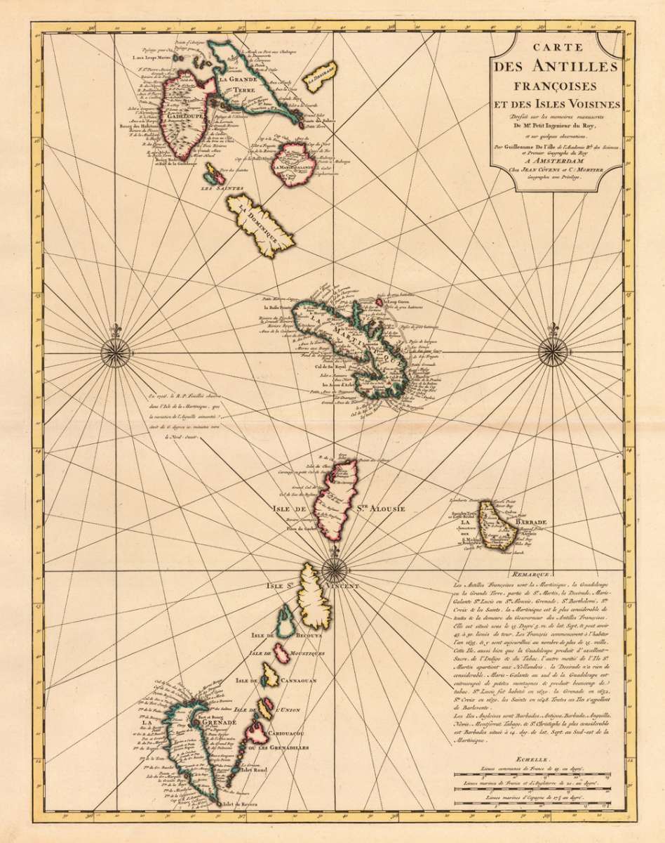
Carte des Antilles Francoises et des Isles Voisines Dresée sur les memoires manuscrits De Mr. Petit Ingenieur du Roy,...
€675.00
Prices incl. VAT plus shipping costs
This item is sold. Please contact us if you are searching for this item.
Eigenschaften
- Published: Covens & Mortier , Amsterdam
- Published date: 1722
- Technique: Copper engraving / Original color.
- Type: Antique Map, map
- Category: Antilles
- Issue date: 1722-40
- Size: 600 by 453mm (23½ by 17¾ inches).
- Stock number: 17326
- Condition: A fine copy of this map, in original outline color and in a strong impression. 600 by 453mm (23½ by 17¾ inches).
Article description
Article description
Copper engraving handcolored in outline when published. A strong and fine impressions of the map of the French Antilles published by Covens & Mortier in Amsterdam. The map was engraved after the cartographic scources by Guilleaume De I'isle. This detailled map of the Antilles is showing the Grenadille islands, St. Vincent, St. Alousie, Barbardos, Martinique, Guadeloupe, Grand Terre, Marie Galante, etc. With many engraved place names, as well three compass roses and a detailled chapter in French text to the history of the French Antilles near the milage scale in the lower right corner.You might also be interested in the following products
 Pas kaart Van de...
 Original antique copper engraving, finely hand colored in outline and wash, probably later hand color. Detailed...
€750.00
 Isle de la...
 Copper engraving, hand colored in outlineand wash. Detailed map showing detailed the Islands of Martinique,...
€95.00
 Isle De La...
 Copper-engraving, handcolored in outline, when published. A fine engraved, detailed map on the island of Martinique...
€136.00
 Martinico to...
 Decorative doublepage handcolored lithograph, showing decorative in a large scale the Island of Martinico, with an...
€268.00
Recently viewed products