Radefeld, Hauptmann von
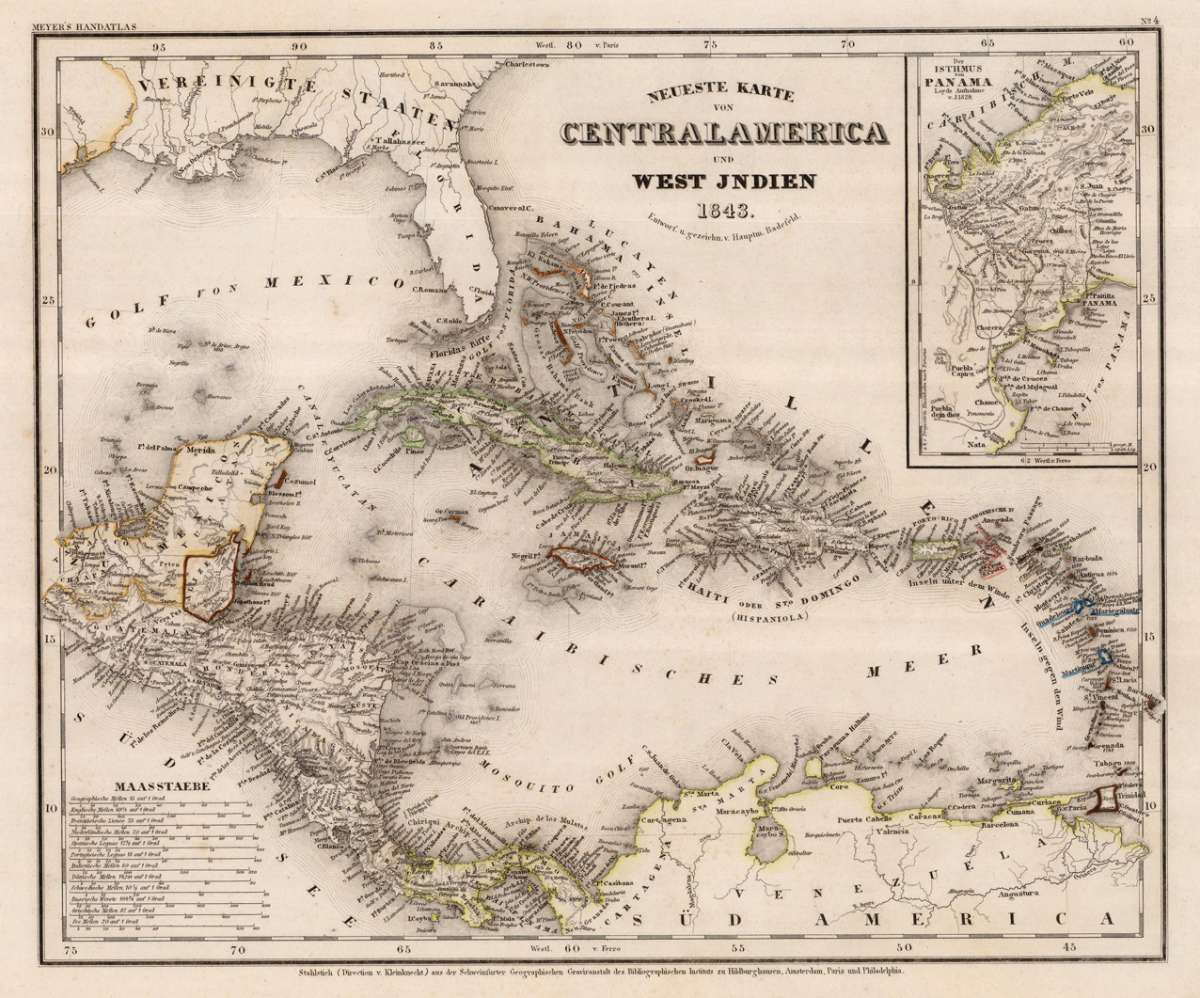
Neueste Karte von Centralamerica und West Indien. Entworf. u. gezeichn. v. Hauptm. Radefeld. 1843.
Eigenschaften
- Published: Meyer , Hildburghausen
- Published date: 1843
- Type: Antique Map, map
- Technique: Steel engraving, original color
- Issue date: 1843
- Category: Central America, Panama & West Indies
- Size: 298 by 362mm (11¾ by 14¼ inches).
- Stock number: 24621
- Condition: In excellent condition. 298 by 362mm (11¾ by 14¼ inches).
Article description
Article description
Steel engraving, hand colored in outline when published. A detailed map of the West Indies, Panama and Central America, published in the large and rare edition of the so-called 'Meyer's Zeitungsatlas' around 1843. The detailed map is equipped with many place names, rivers, mountains and boundaries, further in the upper right corner a small inset map showing the Isthmus of Panama based on Loyds sketch of 1829. In the lower left corner with various engraved mileage scales.You might also be interested in the following products
 A map of the West...
 Copper engraving, uncolored, engraved by Thomas Kitchin. The map shows the West Indies, Florida, the Southern United...
€375.00
 Charte Von...
 Copper engraving in contemporary original color in outline. Unusual map of the West Indies published by the Austrian...
€195.00
 Arcipelago delle...
 Lithograph, hand colored in outline when published. Geographical map from the "Geographical Atlas with Information...
€320.00
Recently viewed products