Van der Aa, Pieter
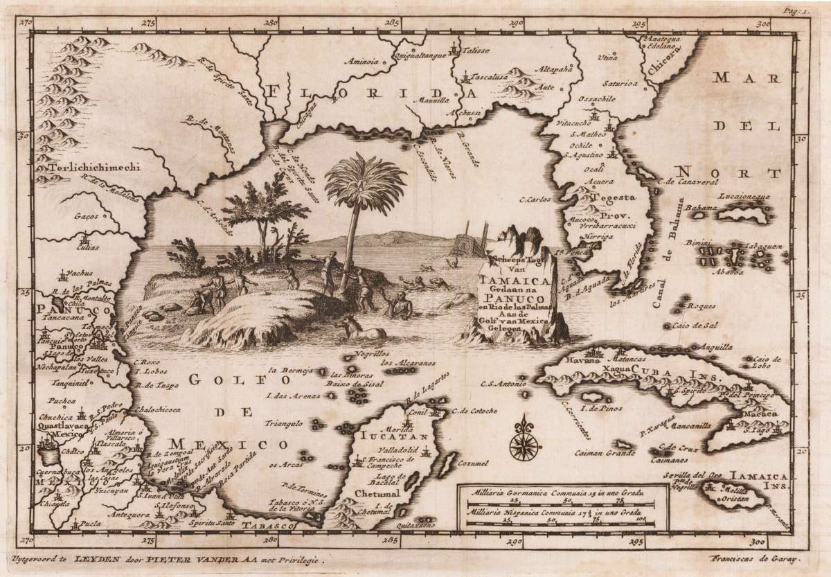
Scheeps Togt van Iamaica Gedaan na Panuco en Rio de Las Palmas Aan de Golf von Mexico gelegen
€375.00
Prices incl. VAT plus shipping costs
This item is sold. Please contact us if you are searching for this item.
Eigenschaften
- Published: Leiden
- Published date: 1706
- Technique: Copper engraving / Uncolored
- Issue date: 1706-08
- Type: map
- Size: 155 by 230mm (6 by 9 inches).
- Stock number: 31848
- Condition: Printed on the full sheet as published; the map was originally folded in this series, so that old folds are more or less visable. Overall in excellent condition.
Article description
Article description
Original copper-engraving, uncoloured as published. A fine engraved map showing the southeastern part of Northamerica with Florida and the gulf of Mexico towards Panuco in the West and the Yucatan peninsula in the South. The map includes further Cuba, Jamaica and the Bahamas. In the centre of the map, actually engraved into the gulf of Mexico, this antique map is equipped with a highly decorative allegoric scene with a shipwreck and its survivors climbing on a small island next to the title cartouche. The famous Dutch publisher and mapmaker Pieter Van der Aa (1659 Leiden - 1733 Leiden) published during the period 1682-1733, an enormous quantity of printed matter (Koeman). This map was actually published in the first edition of his travelbooks ,Naauwkeurige versameling der gedenk-waardigste zee en landreysen na Oost en West-Indien', in Leiden 1706-08.You might also be interested in the following products
 A map of the West...
 Copper engraving, uncolored, engraved by Thomas Kitchin. The map shows the West Indies, Florida, the Southern United...
€375.00
 Neueste Karte von...
 Steel engraving, hand colored in outline when published. A detailed map of the West Indies, Panama and Central...
€132.00
 Charte Von...
 Copper engraving in contemporary original color in outline. Unusual map of the West Indies published by the Austrian...
€195.00
 Arcipelago delle...
 Lithograph, hand colored in outline when published. Geographical map from the "Geographical Atlas with Information...
€320.00
Recently viewed products