Vandermaelen, Phillippe Marie
Amér. Sep. Partie Du Mexique. No. 65.
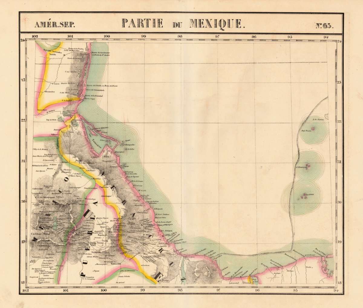
Vandermaelen, Phillippe Marie – Amér. Sep. Partie Du Mexique. No. 65 · Antique Map, Lithograph · 470 x 545mm · Brussels 1825
Eigenschaften
- Published: Brussels
- Published date: 1825
- Type: Antique Map, map
- Issue date: 1825
- Technique: Lithograph / Original color.
- Category: Vera Cruz
- Size: 470 by 545mm (18 by 21 inches).
- Stock number: 16747
- Condition: In excellent condition. 470 by 545mm (18 by 21 inches).
Article description
Article description
Lithograph, hand-colored in outline by Vandermaelen, Phillippe Marie, published 1825 by Brussels. Image size: 470 by 545mm (18 by 21 inches). A rare example from Vandermaelen's landmark Atlas universel — the first lithographic world atlas. Philippe Marie Guillaume Vandermaelen (1795–1869) was a pioneering Flemish cartographer and geographer, often called the 'Mercator of young Belgium'. Working from Brussels, he produced the groundbreaking Atlas universel (1825–1827), the first world atlas printed by lithography and the first to depict the entire globe at a single uniform scale. The atlas comprised six volumes with approximately 390 maps, representing a revolution in cartographic publishing. In 1830 Vandermaelen founded the Établissement géographique de Bruxelles, which housed Belgium's first lithographic press dedicated to cartography alongside a public library and ethnographic museum. His North American maps from the Atlas universel are prized by collectors for their accuracy, delicate lithographic detail, and their historic role as the first such images of the continent produced by the lithographic process. The map is detailed showing the coastline from Barra de Santander over Vera Cruz towards Pres de S. Felipe. Detailed map, which shows as well partially the inland. Smaller villages and rivers are named. In excellent condition.Vandermaelen, Phillippe Marie – Amér. Sep. Partie Du Mexique. No. 65 · Antique Map, Lithograph · 470 x 545mm · Brussels 1825
You might also be interested in the following products
 Hispaniae Novae...
 Copper Engraving, uncolored by Mercator, Gerard, published 1632 by I.E. Cloppenburgh, Amsterdam. Image size: 190 by...
€240.00
 Amèr. Sep. Partie...
 Lithograph, hand-colored in outline by Vandermaelen, Phillippe Marie, published 1827 by Brussels. Image size: 470 by...
€695.00
 Amèr. Sep. Partie...
 Lithograph, hand-colored in outline by Vandermaelen, Phillippe Marie, published 1827 by Brussels. Image size: 458 by...
€400.00
 Amèr. Sep. Partie...
 Lithograph, hand-colored in outline by Vandermaelen, Phillippe Marie, published 1827 by Brussels. Image size: 462 by...
€245.00
Recently viewed products