Bonne, Rigobert
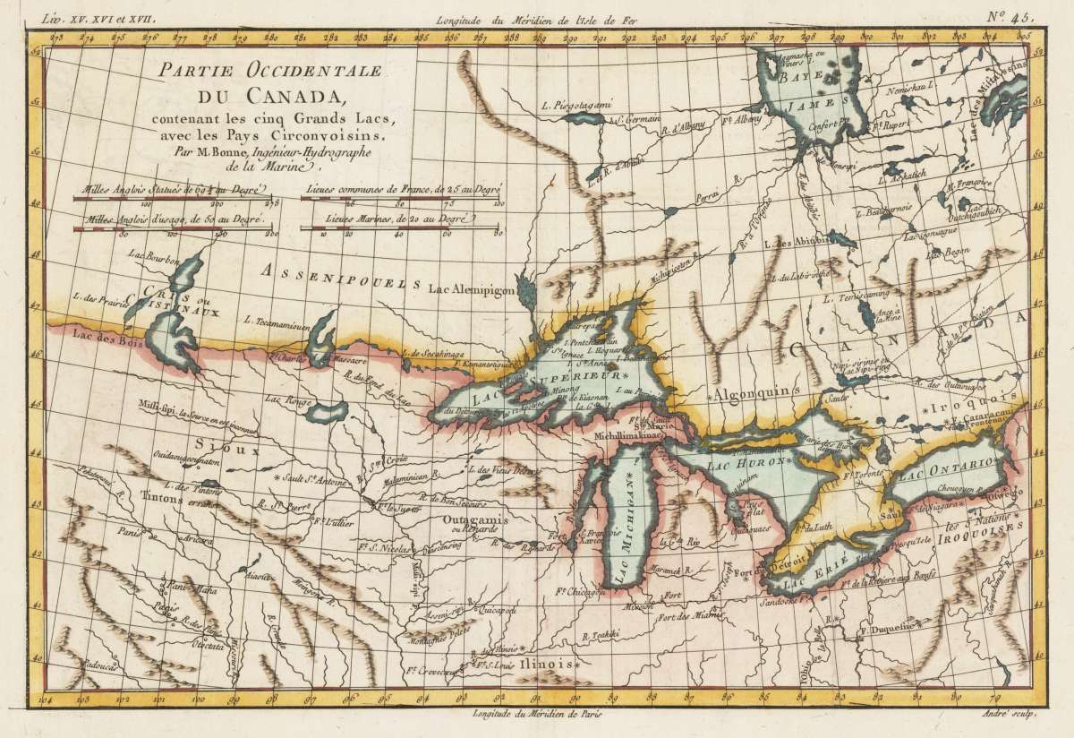
Partie Occidentale du Canada, contenant les cinq Grands Lacs, avec les Pays Circonvoisins. Par M. Bonne,...
€125.00
Prices incl. VAT plus shipping costs
This item is sold. Please contact us if you are searching for this item.
Eigenschaften
- Published: Paris
- Published date: 1780
- Type: Antique Map, map
- Technique: Copper engraving / later hand color
- Category: Canada
- Issue date: 1780
- Size: 213 by 323mm (8½ by 12¾ inches).
- Stock number: 31807
- Condition: In excellent condition.
Article description
Article description
Copper engraving, hand colored in outline and wash. Interesting old map depicting in the centre of the ,Great Lakes' in Eastern Canada. This antique map has a lot of information on the names of forts, rivers, lakes, mountains and Indian tribes of the various regions. Published in Paris around 1780 in an atlas by M. Bonne. Rigobert Bonne (1727-1794) was a French cartographer of the late 18th century. He studied in Paris and practiced cartography. He became a skilled cartographer and hydrographer and became a royal hydrographer at the ,Depot de la Marine' in 1773. In 1780 he engraved and published the maps for Abbe Raynal's work ,Atlas de Toutes Les Parties Connues du Globe Terrestre'. He also published many charts for the ,Depot de la Marine', further he engraved the maps for the ,Atlas Encyclopedique' in 1788 together with Nicholas Desmarest.You might also be interested in the following products
 North America...
 Original antique steel engraving, hand colored in outline when published. On this sheet of the SDUK North America...
€95.00
 Die Staaten von...
 Steel engraving, hand colored in outline when published. This antique map shows the Great Lakes with the Midwest...
€125.00
 Carte...
 Copper engraving, hand colored in outline and wash when published. Fine engraved map of the state of Ohio showing...
€280.00
 (Illinois,...
 Lithograph, original color in outline and wash. This decorative map shows Illinois, Indiana and a part of Ohio....
€295.00
Recently viewed products