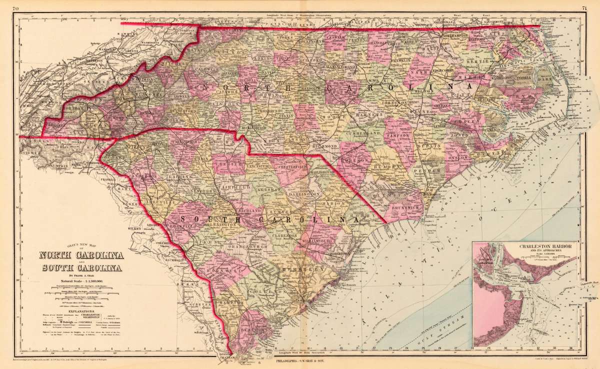
Gray, Frank
Gray's New Map of North Carolina and South Carolina
€95.00
Prices incl. VAT plus shipping costs
This item is sold. Please contact us if you are searching for this item.
Eigenschaften
- Published: O.W. Gray & Son , Philadelphia
- Published date: 1884
- Type: Antique Map, map
- Technique: Lithograph / Original color.
- Issue date: 1884
- Category: Carolina
- Size: 405 by 674mm (16 by 26½ inches).
- Stock number: 14761
- Condition: In very good condition.
Article description
Article description
Lithograph, original color in outline and wash. Detailed map, colored by counties and showing townships, towns, villages, post offices, canals, roads, railroads (projected and completed), towns, etc. An inset map in the lower right corner shows Charleston Harbour and its approaches. A highly detailed map. With detailed explantions below the title.You might also be interested in the following products
 Johnson's Georgia...
 Lithograph, hand-colored in outline by Johnson & Browning, published 1859 by New York. Image size: 395 by 560mm...
€65.00
 Gray's New...
 Lithograph, original color in outline by Gray, Frank, published 1884 by O.W. Gray & Son, Philadelphia. Image...
€70.00
 Amér.Sep....
 Lithograph, hand-colored in outline by Vandermaelen, Phillippe Marie, published 1825 by Brussels. Image size: 463 by...
€177.00
 L'Ancien et...
 Copper Engraving, uncolored by Bonne, Rigobert, published 1787 by M. Bonne, Paris. Image size: 346 by 235mm (13 by 9...
€195.00
Recently viewed products