Vandermaelen, Phillippe Marie
Amér.Sep. Embouchures Du Mississipi. No.61.
Vandermaelen, Phillippe Marie – Amér.Sep. Embouchures Du Mississipi. No.61 · Antique Map, Lithograph · 463 x 525mm · Brussels 1825
Eigenschaften
- Published: Brussels
- Published date: 1825
- Type: Antique Map, map
- Issue date: 1825
- Technique: Lithograph / Original color.
- Category: Mississippi
- Size: 463 by 525mm (18 by 20 inches).
- Stock number: 15741
- Condition: In excellent condition. 463 by 525mm (18 by 20 inches).
Article description
Article description
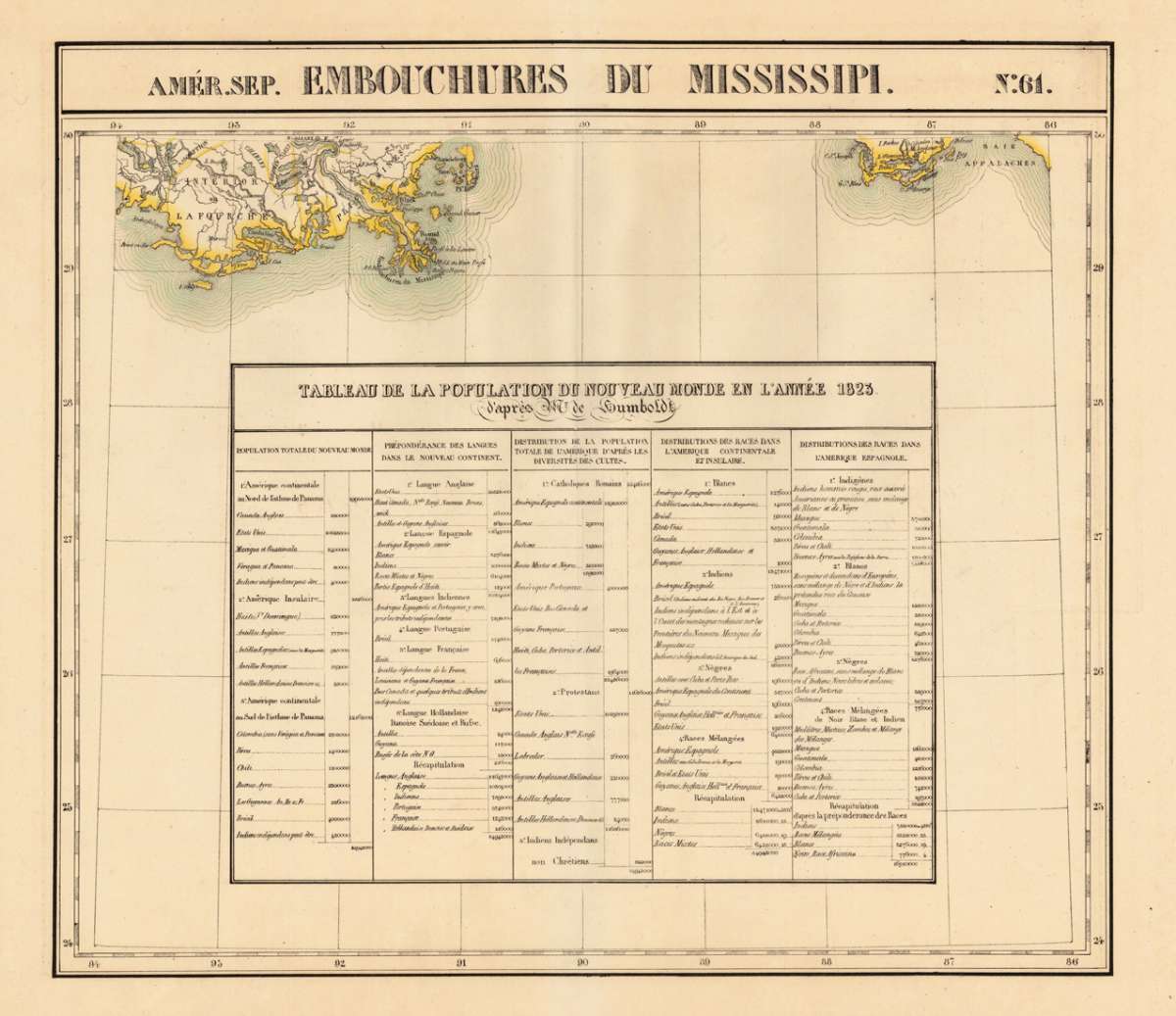
Lithograph, hand-colored in outline by Vandermaelen, Phillippe Marie, published 1825 by Brussels. Image size: 463 by 525mm (18 by 20 inches). A rare example from Vandermaelen's landmark Atlas universel — the first lithographic world atlas. Philippe Marie Guillaume Vandermaelen (1795–1869) was a pioneering Flemish cartographer and geographer, often called the 'Mercator of young Belgium'. Working from Brussels, he produced the groundbreaking Atlas universel (1825–1827), the first world atlas printed by lithography and the first to depict the entire globe at a single uniform scale. The atlas comprised six volumes with approximately 390 maps, representing a revolution in cartographic publishing. In 1830 Vandermaelen founded the Établissement géographique de Bruxelles, which housed Belgium's first lithographic press dedicated to cartography alongside a public library and ethnographic museum. His North American maps from the Atlas universel are prized by collectors for their accuracy, delicate lithographic detail, and their historic role as the first such images of the continent produced by the lithographic process. This highly decorative map shows the region of the mouth of the Mississippi river. The mouth of the Mississippi is detailed shown with New Orleans also the Appalache Bay is shown. In the lower centre of the map is a table of explanation with the population of the New World of 1823 after Alexander von Humboldt. In excellent condition.Vandermaelen, Phillippe Marie – Amér.Sep. Embouchures Du Mississipi. No.61 · Antique Map, Lithograph · 463 x 525mm · Brussels 1825
You might also be interested in the following products
 Johnson's Georgia...
 Lithograph, hand-colored in outline by Johnson & Browning, published 1859 by New York. Image size: 395 by 560mm...
€65.00
 Gray's New...
 Lithograph, original color in outline by Gray, Frank, published 1884 by O.W. Gray & Son, Philadelphia. Image...
€70.00
 L'Ancien et...
 Copper Engraving, uncolored by Bonne, Rigobert, published 1787 by M. Bonne, Paris. Image size: 346 by 235mm (13 by 9...
€195.00
 Neueste Karte von...
 Steel Engraving, hand-colored in outline by Meyer, Joseph & Radefeld, Carl, published 1851 by Bibliograph....
€100.00
Recently viewed products