Weiland, Carl Ferdinand
Der westliche Theil von Mittel-Asien oder Turan mit einem Theil der angaenzenden Laender. Entworfen und gezeichnet...
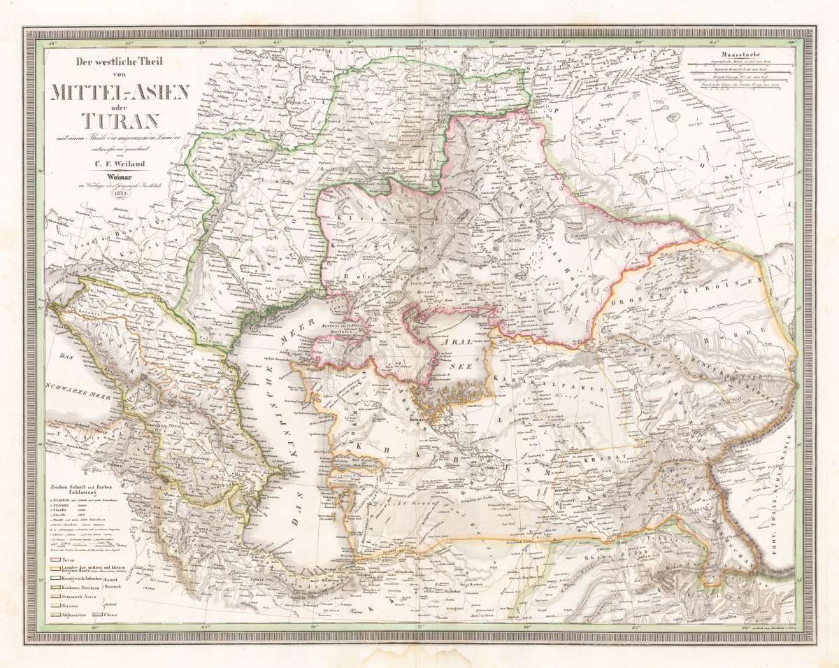
- Published: Weimar
- Published date: 1832
- Issue date: 1832
- Category: Central Asia
- Type: map
- Technique: Copper engraving / hand colored.
- Size: 48 x 61,6 cm (19 x 24,25 inches).
- Stock number: 33570
- Condition: Small water stain at the lower centre, outside the image of the map, else in good condition.
Article description
Original antique copper engraving, hand colored in outline when published. A detailed and interesting map by the German mapmaker Carl Ferdinand Weiland depicting the Middle East and the surrounding. Lower left side with the engraved explanations for the map on cities, towns, villages, castles, fortresses, lighthouses, streets, channels, etc. In the upper right corner a mileage scale for Russian, Persian and French miles. The cartoushe is engraved in the upper left corner. Carl Ferdinand Weiland (* 1782; † May 18, 1847 in Gera) was a German cartographer and Württemberg captain. Weiland worked at the geographical institute in Weimar and succeeded Friedrich Wilhelm Streit in 1817. Weiland's successor was the Berlin cartographer and geographer Heinrich Johann Samuel Kiepert in 1845. Works - General hand atlas of all over the world designed according to the best astronomical provisions, latest discoveries and critical investigations and sent to A.C. Gaspari's complete manuals of the latest earth description determined (1824) - Atlas con America (1824-1828) - Hand atlas (1828/29) - Europe map composed of 4 sheets (1844) - General hand atlas of all over the world. designed according to the latest discoveries (1846) - Carl Ferdinand Weiland, Heinrich Kiepert: The Austral-Continent or New Holland: designed after Krusenstern, King, Flinders, Freycinet, Oxley, Sturt, Mitchell in Mercators Projection (1848) (Wikipedia)
You might also be interested in the following products
 Nouvelle...
  Asiae Nova...
  Von den Ländern...
  Von den Ländern...