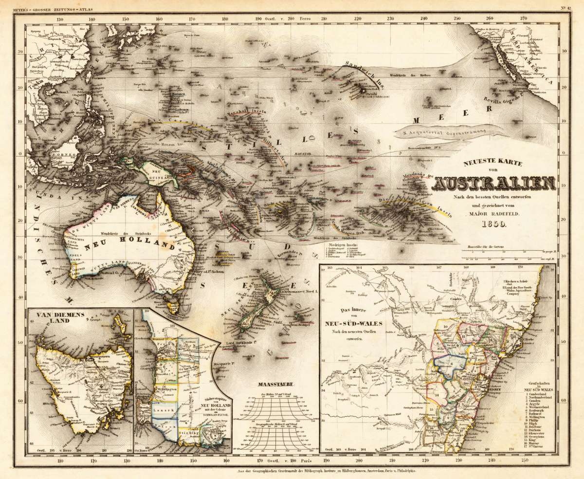
Radefeld, Major
Neueste Karte von Australien. Nach den bessten Quellen entworfen und gezeichnet vom Major Radefeld.
Eigenschaften
- Published: Bibliograph. Institut , Hildburghausen
- Published date: 1850
- Type: Antique Map, map
- Technique: Steel engraving, original color
- Issue date: 1850
- Category: Australia
- Size: 211 by 264mm (8¼ by 10½ inches).
- Stock number: 25637
- Condition: In excellent condition. 211 by 264mm (8¼ by 10½ inches).
Article description
Article description
Steel engraving, hand colored in outline when published. A decorative map of Australia and the Pacific Ocean published in Meyer's famous 'Grossen Zeitungsatlas'.You might also be interested in the following products
 Australien.
 Lithograph, hand colored in outline when published. This map shows Australia with the Pacific Ocean. Inside the map...
€150.00
 Western Autralia...
 Steel engraving, hand colored in outline when published. This map shows West Australia.
€182.00
 J. M. Cilmore´s...
 Original antique lithograph, hand coloured, published by Justus Perthes in Gotha for 'Petermanns Geographische...
€75.00
 Karte der Colonie...
 Original antique lithograph, printed in colours, published by Justus Perthes in Gotha for 'Petermanns...
€80.00
Recently viewed products