Petermann, A.
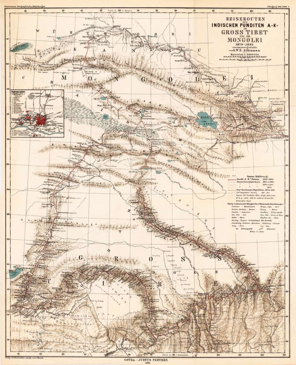
Reiserouten des Indischen Punditen A-K- in Gross Tibet und der Mongolei 1879 - 1882 zusammengestellt von G.W.E....
Petermann, A. – Tibet · Lithograph, Printed in Colours · Petermanns Geographische Mitteilungen, Gotha · 1886
Eigenschaften
- Published: Justus Perthes. , Gotha
- Published date: 1886
- Type: Antique Map, map
- Technique: Lithograph / Original color.
- Issue date: 1886
- Category: Mongolei
- Size: 523 by 428mm (20½ by 16¾ inches).
- Stock number: 25518
- Condition: In excellent condition. The map was originally published folded, so that the old folds are still slightly visible.
Article description
Article description
Original antique lithograph, printed in colours, published by Justus Perthes in Gotha for 'Petermanns Geographische Mitteilungen', 1886. Lithograph, original color in outline. Sheet: 523 by 428mm (20½ by 16¾ inches).. August Heinrich Petermann (1822–1878) was one of the most important German cartographers and geographers of the 19th century. Born in Bleicherode, Saxony, he trained at the Geographische Kunstschule in Potsdam under Heinrich Berghaus — himself a leading student of Alexander von Humboldt. After a formative decade in Edinburgh and London (1845–1854), where he gained broad experience in the commercial and scientific aspects of cartography, Petermann returned to Gotha and joined the Justus Perthes publishing house. In 1855 he founded 'Petermanns Geographische Mitteilungen' (PGM), which swiftly became one of the world's foremost geographical journals — the definitive record of the great age of exploration and discovery. Petermann personally produced over 500 maps and signed 226 articles in PGM, ranging across Africa, the Polar regions, Asia, and the history and practice of cartography. In 1902, the eminent British cartographer J. G. Bartholomew wrote: 'No one has done more than he to advance modern cartography.' His maps are held in major institutions worldwide, including the Library of Congress, the British Library, and the Bibliothèque nationale de France. This decorative map shows Central Asia. The map is equipped with an inset map, which shows the plan of Lhása. In excellent condition. The map was originally published folded, so that the old folds are still slightly visible.Petermann, A. – Tibet · Lithograph, Printed in Colours · Petermanns Geographische Mitteilungen, Gotha · 1886
You might also be interested in the following products
 Karte von Karazm...
 Copper engraving, uncolored as published. Decorative map of Northern India with the neighboring Persia and Tibet....
€65.00
 Tabula Asiae VIII...
 Fine copper-engraved map, printed into the full text page, published in 'Geografia ... Universale de la...
€160.00
 Tabula Asiae VIII...
 Fine copper-engraved map, printed on the full doublepage page, published in the 'Geografia ..' by Claudius...
€145.00
![Antique Tabula Asiae V [Central Asia]](https://bergbook.com/media/image/1b/4e/43/19473_500x500@2x.jpg "Tabula Asiae V [Central") Tabula Asiae V...
Tabula Asiae V... Woodcut map from "Geographiae Libri VIII..." published in Basel at Heinrich Petri. A highly decorative woodcut map...
€250.00
Recently viewed products