Petermann, A.
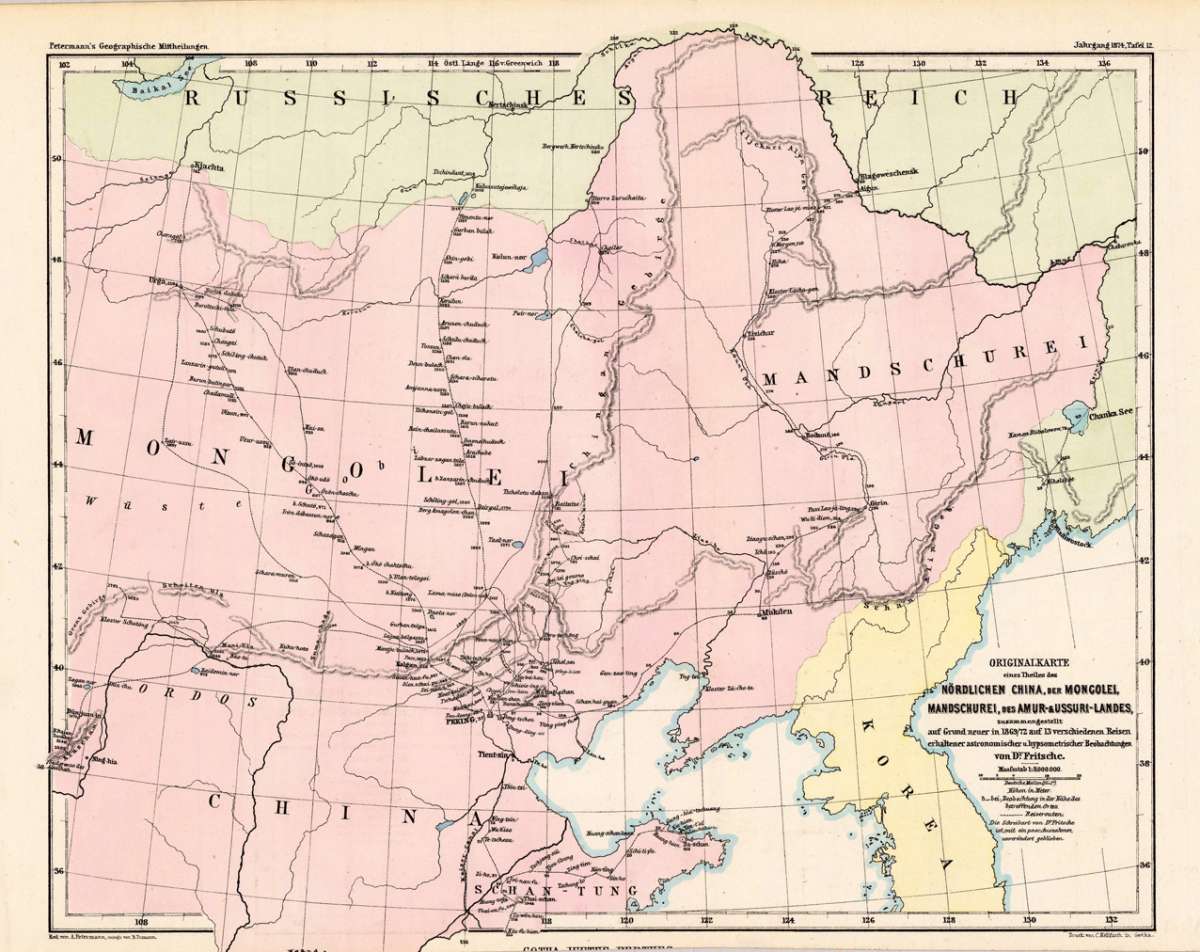
Originalkarte eines Theiles des nördlichen China, der Mongolei, Mandschurei, des Amur-&Ussuri-Landes,...
Petermann, A. – China · Lithograph, Printed in Colours · Petermanns Geographische Mitteilungen, Gotha · 1876
Eigenschaften
- Published: Justus Perthes. , Gotha
- Published date: 1876
- Type: Antique Map, map
- Technique: Lithograph
- Issue date: 1876
- Category: Northern China & Corea
- Size: 245 by 309mm (9¾ by 12¼ inches).
- Stock number: 18959
- Condition: In excellent conditon.
Article description
Article description
Original antique lithograph, printed in colours, published by Justus Perthes in Gotha for 'Petermanns Geographische Mitteilungen', 1876. Lithograph, original color. Sheet: 245 by 309mm (9¾ by 12¼ inches).. August Heinrich Petermann (1822–1878) was one of the most important German cartographers and geographers of the 19th century. Born in Bleicherode, Saxony, he trained at the Geographische Kunstschule in Potsdam under Heinrich Berghaus — himself a leading student of Alexander von Humboldt. After a formative decade in Edinburgh and London (1845–1854), where he gained broad experience in the commercial and scientific aspects of cartography, Petermann returned to Gotha and joined the Justus Perthes publishing house. In 1855 he founded 'Petermanns Geographische Mitteilungen' (PGM), which swiftly became one of the world's foremost geographical journals — the definitive record of the great age of exploration and discovery. Petermann personally produced over 500 maps and signed 226 articles in PGM, ranging across Africa, the Polar regions, Asia, and the history and practice of cartography. In 1902, the eminent British cartographer J. G. Bartholomew wrote: 'No one has done more than he to advance modern cartography.' His maps are held in major institutions worldwide, including the Library of Congress, the British Library, and the Bibliothèque nationale de France. This antique map shows the nortnern part of China, with the neighboring Corea, the Mongolei, the Mandschurei and the Amur-& Ussuri-country with many engraved rivers, trails and place names, etc. In excellent conditon.Petermann, A. – China · Lithograph, Printed in Colours · Petermanns Geographische Mitteilungen, Gotha · 1876
You might also be interested in the following products
 Xansi. Imperii...
 Original antique copper engraving, hand colored in outline published in Joan Blaeu's 'Atlas Novus'....
€600.00


Recently viewed products