Bellin, Nicolaus
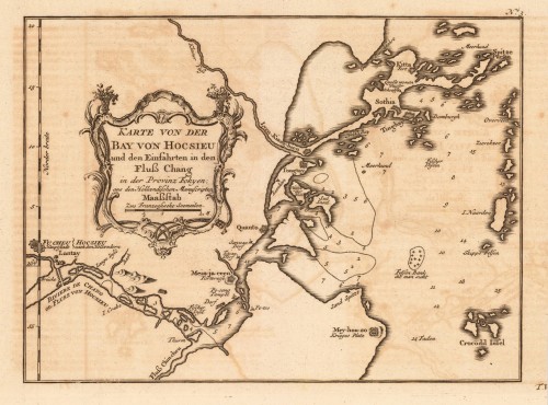
Carte de la Baye de Chin-Cheouw ou Chang-Cheouw Avec les Isles d´Emowi et de Quemowi Dressée sur Divers Manuserits,...
Eigenschaften
- Published: Paris
- Published date: 1760
- Technique: Copper engraving / Uncolored
- Issue date: 1760
- Type: map
- Category: Bay of Zhangzhou
- Size: 210 by 300mm (8¼ by 11¾ inches).
- Stock number: 25855
- Condition: In excellent condition.
Article description
Article description
Copper engraving, uncolored as published. The map shows the current city of Xiamen. This nautical chart offers only limited details inland, but the city of Amoy (Xiamen), as well as adjacent points of interest including fortifications, palaces, pagodas, and nearby cities, are rendered pictorially. On the island itself a large mountain, most likely Xianyue Mountain, with a tower, is depicted. Published in an atlas volume of Nicolaus Bellin's ,Histoire generale des Voyages' around 1760 in Paris. Recently viewed products


