Petermann, A.
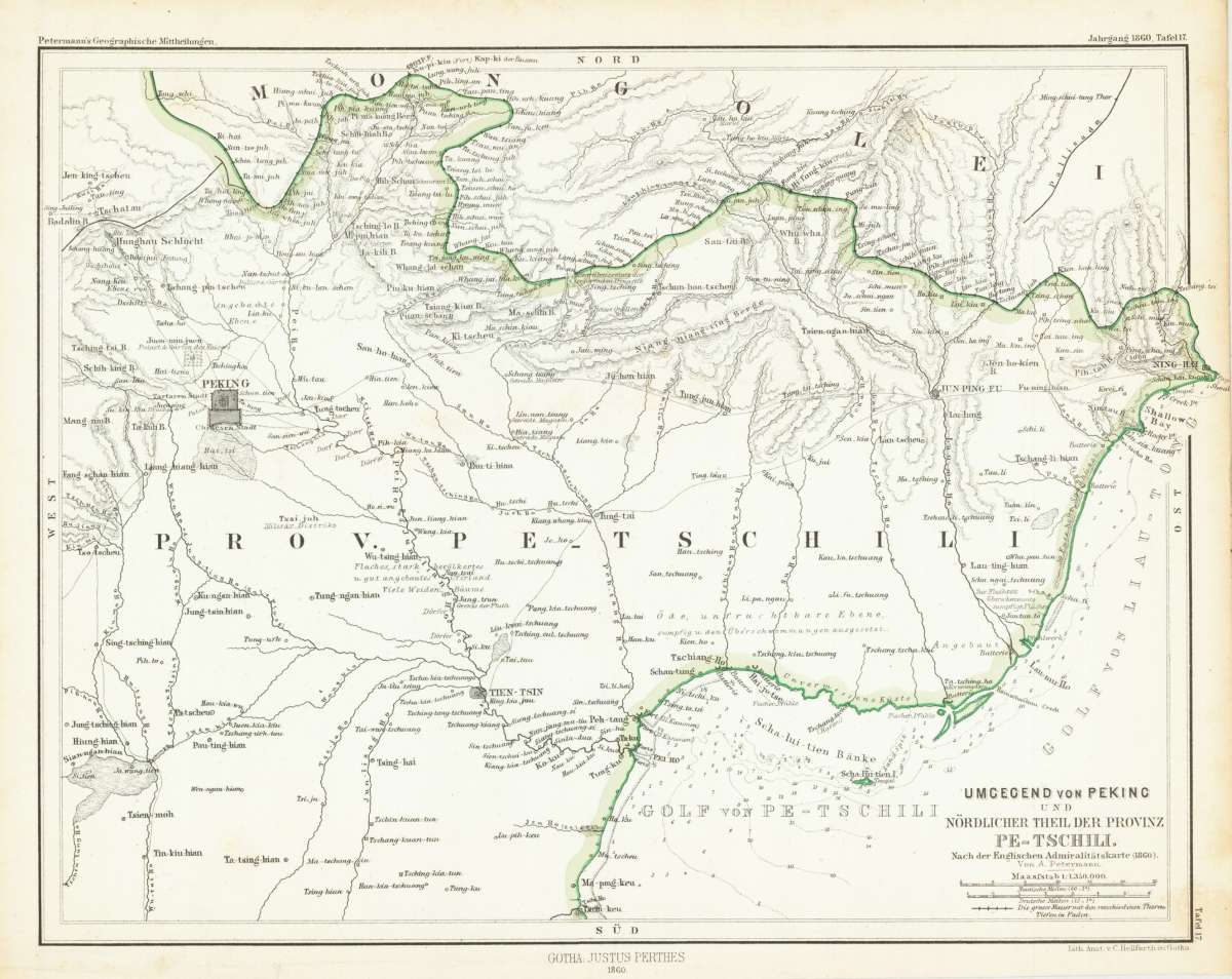
Umgegend von Peking und nördlicher Theil der Provinz Pe-Tschili. - Nach der Englischen Admiralitätskarte (1860). -...
Petermann, A. – The map is equipped with detailed information on · Lithograph, Printed in Colours · Petermanns Geographische Mitteilungen, Gotha · 1860
Eigenschaften
- Published: Gotha
- Published date: 1860
- Technique: Lithograph
- Issue date: 1860
- Category: Peking - Provinz Pe-Tschili
- Type: map
- Size: 192 by 247mm (7½ by 9¾ inches).
- Stock number: 27182
- Condition: In excellent conditon.
Article description
Article description
Original antique lithograph, printed in colours, published by Justus Perthes in Gotha for 'Petermanns Geographische Mitteilungen', 1860. Lithograph, original color. Sheet: 192 by 247mm (7½ by 9¾ inches).. August Heinrich Petermann (1822–1878) was one of the most important German cartographers and geographers of the 19th century. Born in Bleicherode, Saxony, he trained at the Geographische Kunstschule in Potsdam under Heinrich Berghaus — himself a leading student of Alexander von Humboldt. After a formative decade in Edinburgh and London (1845–1854), where he gained broad experience in the commercial and scientific aspects of cartography, Petermann returned to Gotha and joined the Justus Perthes publishing house. In 1855 he founded 'Petermanns Geographische Mitteilungen' (PGM), which swiftly became one of the world's foremost geographical journals — the definitive record of the great age of exploration and discovery. Petermann personally produced over 500 maps and signed 226 articles in PGM, ranging across Africa, the Polar regions, Asia, and the history and practice of cartography. In 1902, the eminent British cartographer J. G. Bartholomew wrote: 'No one has done more than he to advance modern cartography.' His maps are held in major institutions worldwide, including the Library of Congress, the British Library, and the Bibliothèque nationale de France. This map shows the surrounding of Peking with the northern province Pe-Tschili. The map is equipped with detailed information on rivers, small place names, etc. Diese Landkarte zeigt die Umgebung von Peking und den nördlichen Teil der Provinz Pe-Tschili. Die Karte zeigt außerdem detaillierte Ortsangaben und den Verlauf verschiedener Flüsse.Petermann, A. – The map is equipped with detailed information on · Lithograph, Printed in Colours · Petermanns Geographische Mitteilungen, Gotha · 1860
You might also be interested in the following products
 Xansi. Imperii...
 Original antique copper engraving, hand colored in outline published in Joan Blaeu's 'Atlas Novus'....
€600.00


Recently viewed products