Vaugondy, Gilles Robert de
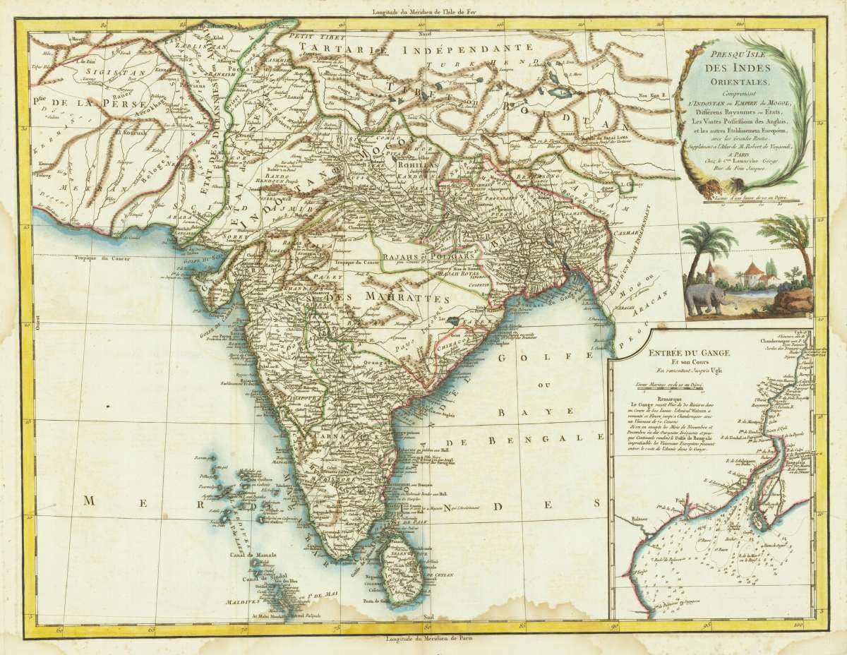
Presqu Isle Des Indes Orientales, Comprenant L'Indostan ou Empire du Mogol, Differens Royaumes out Etats, Les...
€175.00
Prices incl. VAT plus shipping costs
This item is sold. Please contact us if you are searching for this item.
Eigenschaften
- Published: Paris
- Published date: 1786
- Issue date: 1786
- Type: map
- Technique: Copper engraving / hand colored.
- Size: 475 by 620mm (18¾ by 24½ inches).
- Stock number: 31673
- Condition: Waterstains in the margins just effecting the image.
Article description
Article description
Original copper engraving, hand colored when published in outline and wash Very detailed map of India, with inset map of the mouth of the river Ganges (includes illustration of an elephant, trees and church below), detailing the Colonial holdings of the British and other European powers, the States of India and the major roads through India. The map identifies Delhi, Calcutta, Pondicherry, Agra, Bombay, Goa and other major and minor cities.You might also be interested in the following products
 Partie De La...
 Copper-engraving, handcolored in wash and outline. Decorative engraved map showing the northern part of India with...
€95.00
 Agra - Die Stadt...
 Copper-engraving, handcolored in wash and outline. Decorative city view showing the city of Agra in India, ornated...
€95.00
 Vicerex Classem...
 Copper engraving uncolored as published. Early scene of a meeting of Spanish conquerors with inhabitants in India.
€145.00
 Die Stadt Visapor...
 Copper-engraving, handcolored in wash and outline. Decorative view of the India.city of Visapor in India.
€95.00
Recently viewed products