Mallet, Allain Manesson
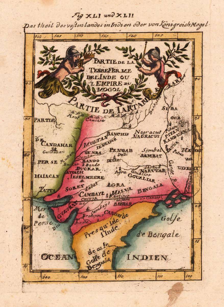
Partie De La Terre Ferme De L Inde ou L Empire du Mogol. - Das theil des vesten landes in Indien oder von Königreich...
Eigenschaften
- Published: Frankfurt
- Published date: 1719
- Type: Antique Map, map
- Technique: Copper engraving / later handcolor
- Issue date: 1719
- Category: India
- Size: 150 by 110mm (6 by 4 inches).
- Stock number: 17982
- Condition: In excellent condition. 150 by 110mm (6 by 4 inches).
Article description
Article description
Copper-engraving, handcolored in wash and outline. Decorative engraved map showing the northern part of India with the gulf of Bengal and the neighbouring regions towards the Himalaya.You might also be interested in the following products
 Agra - Die Stadt...
 Copper-engraving, handcolored in wash and outline. Decorative city view showing the city of Agra in India, ornated...
€95.00
 Vicerex Classem...
 Copper engraving uncolored as published. Early scene of a meeting of Spanish conquerors with inhabitants in India.
€145.00
 Die Stadt Visapor...
 Copper-engraving, handcolored in wash and outline. Decorative view of the India.city of Visapor in India.
€95.00
 Erythraei Sive...
 Original antique copper engraving, hand colored in outline when published. Published in a Dutch text edition of J....
€345.00
Recently viewed products