Petermann, A.
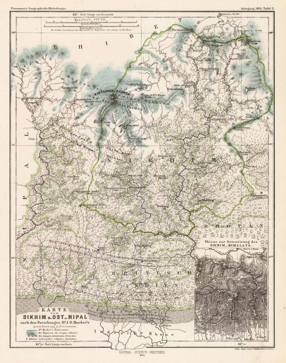
Karte von Sikhim u. Ost-Nipal nach den Forschungen Dr. J. D. Hooker´s - gezeichnet von A. Petermann.
Petermann, A. – Sikkim · Lithograph, Hand Coloured · Petermanns Geographische Mitteilungen, Gotha · 1861
Eigenschaften
- Published: Justus Perthes. , Gotha
- Published date: 1861
- Type: Antique Map, map
- Technique: Lithograph / Original color.
- Issue date: 1861
- Category: Sikim & Eastern Nipal
- Size: 244 by 192mm (9½ by 7½ inches).
- Stock number: 18524
- Condition: In excellent condition. 244 by 192mm (9½ by 7½ inches).
Article description
Article description
Original antique lithograph, hand coloured, published by Justus Perthes in Gotha for 'Petermanns Geographische Mitteilungen', 1861. Original lithograph, handcolored in outline. Sheet: 244 by 192mm (9½ by 7½ inches).. August Heinrich Petermann (1822–1878) was one of the most important German cartographers and geographers of the 19th century. Born in Bleicherode, Saxony, he trained at the Geographische Kunstschule in Potsdam under Heinrich Berghaus — himself a leading student of Alexander von Humboldt. After a formative decade in Edinburgh and London (1845–1854), where he gained broad experience in the commercial and scientific aspects of cartography, Petermann returned to Gotha and joined the Justus Perthes publishing house. In 1855 he founded 'Petermanns Geographische Mitteilungen' (PGM), which swiftly became one of the world's foremost geographical journals — the definitive record of the great age of exploration and discovery. Petermann personally produced over 500 maps and signed 226 articles in PGM, ranging across Africa, the Polar regions, Asia, and the history and practice of cartography. In 1902, the eminent British cartographer J. G. Bartholomew wrote: 'No one has done more than he to advance modern cartography.' His maps are held in major institutions worldwide, including the Library of Congress, the British Library, and the Bibliothèque nationale de France. Detailled map of Sikhim and Eastern Nipal with the neighbouring Tibet and Mt. Kintschin-Djunga based on the expeditions of Dr. J.D. Hooker. The map provides pretty good information on elevations, various woods, mountains, rivers, glaciers and monastries. In the lower right corner a small inset map to the 'Sikhim-Himalaya'. In excellent condition.Petermann, A. – Sikkim · Lithograph, Hand Coloured · Petermanns Geographische Mitteilungen, Gotha · 1861
You might also be interested in the following products
 Reise indischer...
 Original antique lithograph, hand coloured, published by Justus Perthes in Gotha for 'Petermanns Geographische...
€145.00

 Plan von Wara....
 Original antique lithograph, hand coloured, published by Justus Perthes in Gotha for 'Petermanns Geographische...
€95.00
 Carte Du Grand...
 Copper engraving, uncolored as published. An interesting small and detailled antique map of Grand Thibet, these days...
€55.00
Recently viewed products