Jaillot, Alexis-Hubert & Sanson, N.
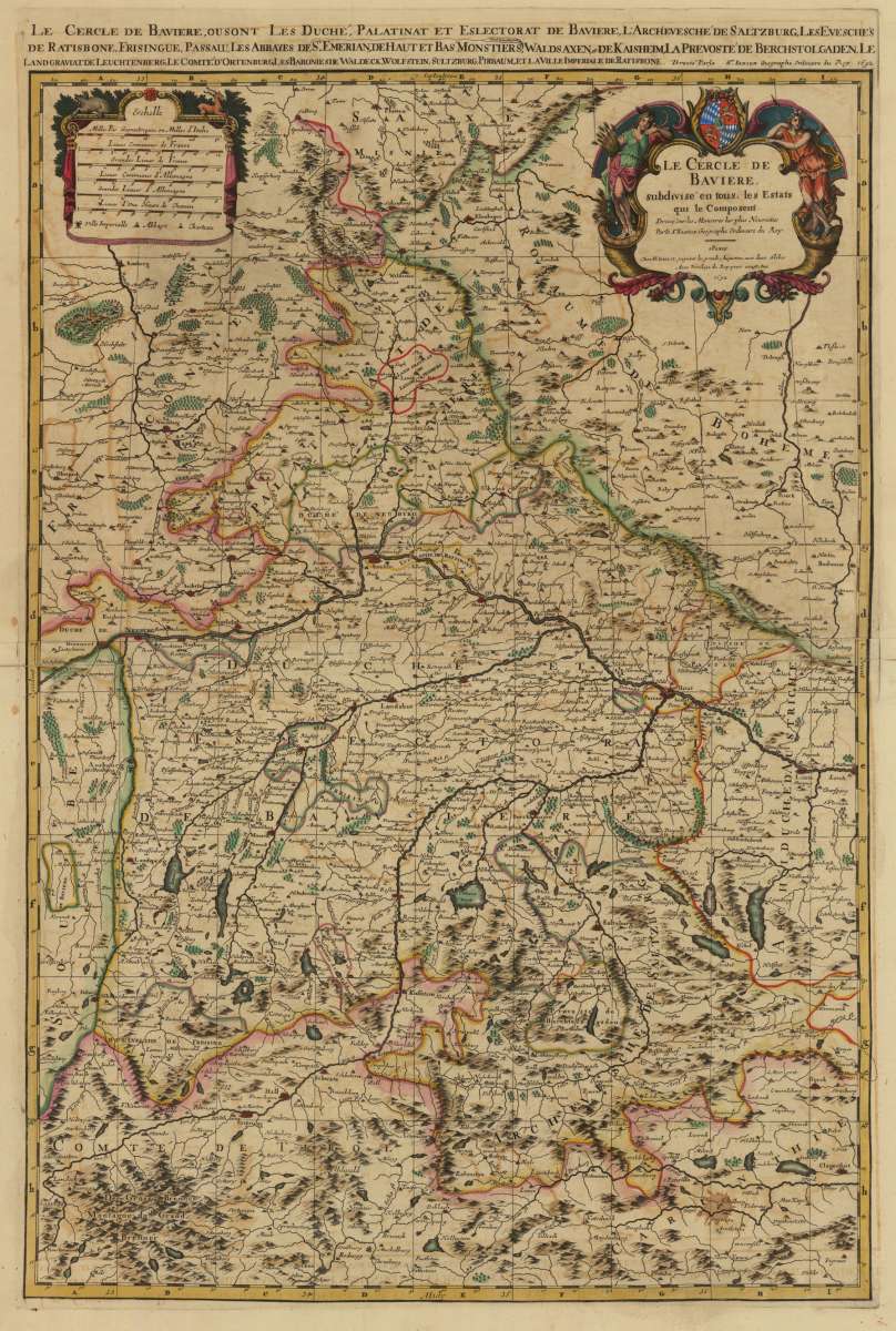
Le Cercle de Baviere, subdivise en tous les Estats qui le Composent Dresse sur le Memoires les plus Nouveaux Parle...
Prices incl. VAT plus shipping costs
This item is sold. Please contact us if you are searching for this item.
- Published: Paris
- Published date: 1692
- Category: Bayern
- Technique: Copper engraving / Original color
- Issue date: 1692
- Type: map
- Size: 803 by 560mm (31 by 22 inches).
- Stock number: 32844
- Condition: In very good condition.
Article description
Original engraved map, hand colored in outline when published. Equipped with a large fine allegoric title cartouche, in upper centre with the coats of arms of Bavaria. All fully old hand colored in the period when published. The map shows the circle of Bavaria. In the north with neighboring Saxony and in the south towards the Brenner and Tirol. In the east with parts of Austria and Bohemia, in the west with neighboring Franconia and Swabia. The map image is carefully and clearly engraved with many place names of cities, towns and even small villages, mountains, rivers and lakes. In the upper left corner an additional cartouche with mileage scales. The,Atlas Nouveau...' was commissioned by Louis XIV and its preparation lasted more than 10 years. It is still considered a masterpiece of French cartography of the 17th century. Overall in very good condition. This large map was printed from two engraved plates. Some minor marginal fraying or small tears in the margins or folds. Most of them old mended. A very decorative map in beautiful hand color.
You might also be interested in the following products
 Le Cercle de...
  Le Cercle de...
  Lindau im boden...
  Glyptothek