Bonne, Rigobert
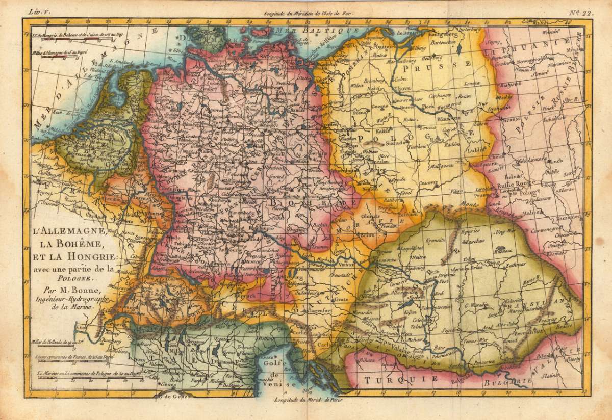
L'Allemagne, la Boheme, et la Hongrie: avec une partie de la Pologne. Par M. Bonne, Ingenr. Hydrographe de la...
€65.00
Prices incl. VAT plus shipping costs
This item is sold. Please contact us if you are searching for this item.
Eigenschaften
- Published: M. Bonne , Paris
- Published date: 1780
- Type: Antique Map, map
- Technique: Copper engraving / later hand color
- Issue date: 1780-88
- Category: Germany, Poland & Hungary
- Size: 213 by 320mm (8½ by 12½ inches).
- Stock number: 23853
- Condition: Minor water stain at the left and right blank margins. The map was originally published folded, so that the old folds are still slightly visible. In very good to excellent condition.
Article description
Article description
Copper engraving, hand colored in outline and wash. Decorative and detailed map of Central europe with Germany, Poland, Hungary and Austria. With many engraved place names, rivers and mountains. Rigobert Bonne (1727-1794) was a French cartographer of the late 18th century. He studied in Paris and practiced cartography. He became a skilled cartographer and hydrographer and became a royal hydrographer at the ,Depot de la Marine' in 1773. In 1780 he engraved and published the maps for Abbe Raynal's work ,Atlas de Toutes Les Parties Connues du Globe Terrestre'. He also published many charts for the ,Depot de la Marine', further he engraved the maps for the ,Atlas Encyclopedique' in 1788 together with Nicholas Desmarest.You might also be interested in the following products
 Trier - Koblentz...
 Original copper engraving, hand colored in wash published ca. 1572-78 in volume I of the famous town book...
€595.00
 Neus
Neus Original antique copper engraving, hand colored in wash and published ca. 1619 in volume IV of the famous town book...
€745.00
 Campidonia vulgo...
 Original copper engraving, hand colored in wash published ca. 1572-78 in volume II of the famous town book...
€850.00
 Novesium vulgo...
 Original copper engraving, hand colored in wash, published 1572-78 in volume II of the town book 'Civitates...
€800.00
Recently viewed products