Visscher, Nicolaus
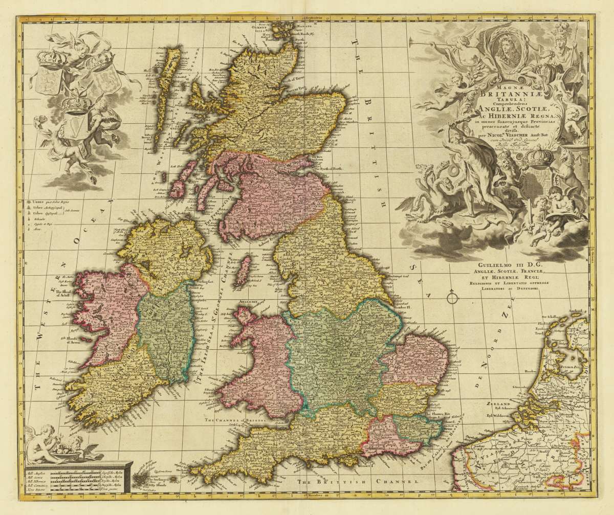
Magne Britanniae Tabula; Comprehendens Angliae, Scotiae, Ac Hiberniae Regna, in omnes suascujusque Provincias...
€480.00
Prices incl. VAT plus shipping costs
This item is sold. Please contact us if you are searching for this item.
Eigenschaften
- Published: Amsterdam
- Published date: 1696
- Technique: Copper engraving / Original color.
- Category: British Isles
- Type: map
- Issue date: 1683-96
- Size: 475 by 590mm (18¾ by 23¼ inches).
- Stock number: 29712
- Condition: In excellent condition.
Article description
Article description
Copper engraving, hand colored in outline and wash when published. Decorative antique map of the British Isles showing England, Scotland and Ireland. This highly decorative rare map of the late 17th century is equipped with a large allegoric title cartouche in the upper right corner, further at the left side with engraved coat of arms held by angels. At the bottom a small mileage scale with two putti. With many engraved place names and details, the political borders shown in outline and wash color of the period as published. The map was first published by the Dutch mapmaker and publisher Nicolaus Visscher in Amsterdam, here with the additional engraved imprint ,Nunc apud P. Schenk Jun.' of P. Schenk (Petrus Schenk the younger) below of the last line of the title cartouche. A fine example in original outline and wash color of the period when published with full margins as published.You might also be interested in the following products

 De Custen van...
 Fascinating detailed seachart of the south-eastern coast of England showing the coastline from Lizard Point over...
€950.00
 Li Regni D'...
 Copper engraving, in contemporary original color in outline. Published in Zatta's "Atlante Novissimo"....
€245.00
 Neueste Karte von...
 Steelengraving, handcolored in outline when published. The detailled map of the British Isles is providing a lot of...
€80.00
Recently viewed products