Zatta, Antonio
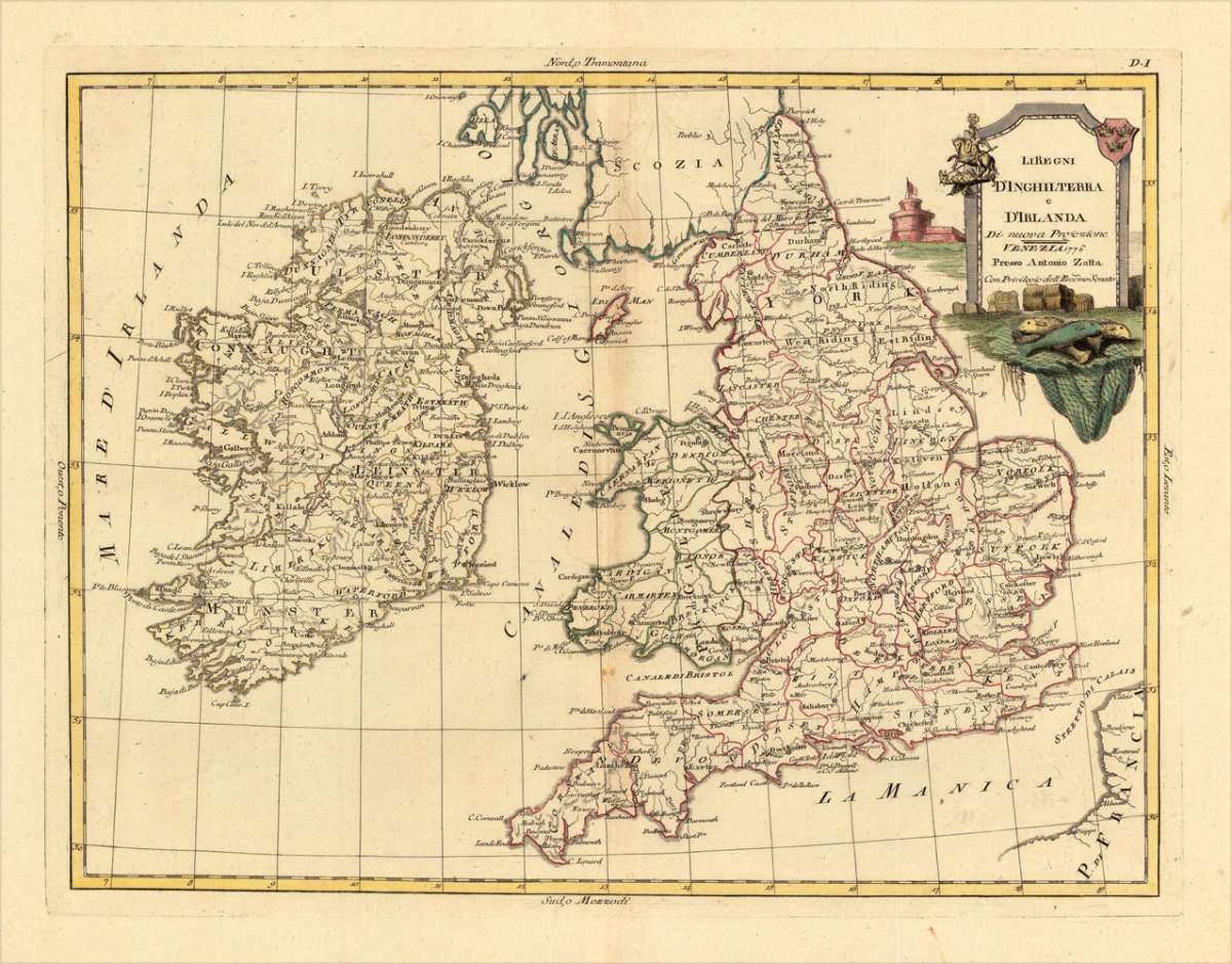
Li Regni D' Inghilterra e D' Irlanda Di nuova Projezione
Eigenschaften
- Published: Antonio Zatta. , Venice
- Published date: 1776
- Technique: Copper engraving / Original color.
- Type: Antique Map, map
- Issue date: 1776.
- Category: England & Ireland
- Size: 402 by 310mm (15¾ by 12¼ inches).
- Stock number: 16823
- Condition: In excellent condition. 402 by 310mm (15¾ by 12¼ inches).
Article description
Article description
Copper engraving, in contemporary original color in outline. Published in Zatta's "Atlante Novissimo". Decorative map by the famous late 18th century north-italian cartographer Antonio Zatta. With many names of villages, as well engraved mountains and rivers are showns. The handcolored engraved title cartouche ornated with a landscape. A small milage scale.You might also be interested in the following products
 Neueste Karte von...
 Steelengraving, handcolored in outline when published. Detailled map of Great Britain and Ireland with many...
€80.00
 General Carte von...
 Original antique copper engraving, hand colored in outline and wash, when published. Detailled map of the British...
€195.00
 Carte des Grandes...
 Copper-engraving, handcolored in outline, when published. Detailed map by the French cartographer Sr. Robert de...
€350.00
 Neueste Karte von...
 Steelengraving, handcolored in outline when published. Detailled map of Great Britain and Ireland with many...
€80.00
Recently viewed products